|
search place name
|
||
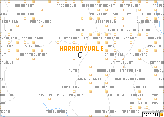
Harmony Vale (Saint Ann, Jamaica)Harmony Vale is a town in the Saint Ann region of Jamaica. An overview map of the region around Harmony Vale is displayed below.
regional and 3d topo map of Harmony Vale, Jamaica ::
Harmony Vale airports ::
The nearest airport is OCJ - Ocho Rios Boscobel, located 28.8 km north east of Harmony Vale.
Other airports nearby include KTP - Kingston Tinson Pen (50.3 km south east), KIN - Kingston Norman Manley Intl (57.0 km south east), POT - Port Antonio Ken Jones (70.8 km east), MBJ - Montego Bay Sangster Intl (79.8 km west), Nearby towns ::
Browns Valley (1.9km north) //
Pedro (1.9km north) //
Hutchensons Turret (1.8km west) //
York Castle (1.8km west) //
Grier Park (2.6km north east) //
New York (2.6km south east) //
Hutchensons Hale (2.6km south west) //
Alderton (4.1km north west) //
Limetree Valley (4.1km north west) //
Walton (4.1km south west) //
Bally Mony (4.1km south east) //
Essex (4.1km south west) //
Bensonton (4.1km south west) //
Golden Grove (4.1km south east) //
Barrett Hall Village (5.1km north east) //
Friendship (5.3km east) //
Brunswick (5.6km north) //
Tows Pen (5.6km north) //
Woolbury (5.6km east) //
Concord (5.8km south) //
Lucky Valley (5.8km south) //
Claremont (5.8km north) //
Coultant Grove (5.8km north) //
Crescent Park (6.5km north east) //
Saint Mountain (6.5km north east) //
Brissett Run (6.5km north west) //
Cedar Valley (6.5km north west) //
Broadstreet (6.6km north east) //
Gibraltar (6.5km south east) //
[all distances 'as the bird flies' and approximate] 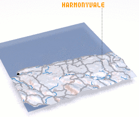 Places with similar names to Harmony Vale, Jamaica ::
// Harmony Villa (US)
// Hermanville (US)
// Hermanville (US)
// Harmonyvale (US)
// Hermanville (US)
// Harmonville (US)
// Harmonyville (US)
// Harmonyville (US)
// Hermonville (FR)
// Harmon Valley (CA)
Disclaimer :: Information on this page comes without warranty of any kind |
||
|
Where is Harmony Vale? Elevation and coordinates ::
Latitude (lat): 18°16'0"N Longitude (lon): 77°12'0"W
Elevation (approx.): 495m (map arrows pan, magnifying glasses zoom) |
||
|
Visiting Harmony Vale? Hotel/Accommodation ::
Book a hotel in Harmony Vale Travel Guide ::
Buy a travel guide for Jamaica rental cars ::
car rental offers GPS waypoint ::
download a GPX waypoint (PoI) of Harmony Vale for your GPS receiver
|
||