|
search place name
|
||
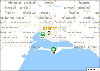
Kencot (Saint Andrew, Jamaica)Kencot is a town in the Saint Andrew region of Jamaica. An overview map of the region around Kencot is displayed below.
regional and 3d topo map of Kencot, Jamaica ::
Kencot airports ::
The nearest airport is KTP - Kingston Tinson Pen, located 2.6 km west of Kencot.
Other airports nearby include KIN - Kingston Norman Manley Intl (5.4 km south), POT - Port Antonio Ken Jones (36.9 km north east), OCJ - Ocho Rios Boscobel (49.9 km north), MBJ - Montego Bay Sangster Intl (131.1 km north west), Nearby towns ::
Jones Town (0.0km north) //
Admiral Town (0.0km north) //
Newport East (1.9km south) //
Trench Town (1.9km south) //
Half Way Tree (1.9km north) //
Kingston (1.9km north) //
Vineyard Town (1.8km east) //
Delacree Pen (1.8km west) //
Cross Roads (1.8km east) //
Whitfield Town (1.8km west) //
Up Park Camp (1.8km east) //
Greenwich Town (2.6km south west) //
Cockburn Gardens (2.6km north west) //
New Kingston (2.6km north east) //
Eden Gardens (3.5km east) //
Three Mile (3.5km west) //
Newport West (3.5km west) //
Eastwood Park (3.7km north) //
Cassia Park (3.7km north) //
Camperdown (3.7km north) //
Mountain View Gardens (4.0km south east) //
Bournemouth Gardens (4.0km south east) //
Vineyard Town (4.0km south east) //
Rollington Town (4.0km south east) //
Niger Corner (4.0km north east) //
Beverly Hills (4.0km north east) //
Four Mile (4.0km north west) //
Tree Grove (4.1km north west) //
Four Roads (4.1km north west) //
[all distances 'as the bird flies' and approximate] 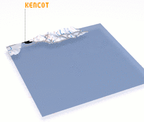 Places with similar names to Kencot, Jamaica ::
Disclaimer :: Information on this page comes without warranty of any kind |
||
|
Where is Kencot? Elevation and coordinates ::
Latitude (lat): 17°59'0"N Longitude (lon): 76°48'0"W
Elevation (approx.): 29m (map arrows pan, magnifying glasses zoom) |
||
|
Visiting Kencot? Hotel/Accommodation ::
Book a hotel in Kencot Travel Guide ::
Buy a travel guide for Jamaica rental cars ::
car rental offers GPS waypoint ::
download a GPX waypoint (PoI) of Kencot for your GPS receiver
|
||