|
search place name
|
||
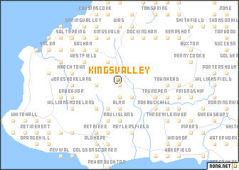
Kings Valley (Westmoreland, Jamaica)Kings Valley is a town in the Westmoreland region of Jamaica. An overview map of the region around Kings Valley is displayed below.
regional and 3d topo map of Kings Valley, Jamaica ::
Kings Valley airports ::
The nearest airport is MBJ - Montego Bay Sangster Intl, located 36.7 km north east of Kings Valley.
Other airports nearby include OCJ - Ocho Rios Boscobel (130.5 km east), KTP - Kingston Tinson Pen (150.1 km east), KIN - Kingston Norman Manley Intl (155.3 km east), POT - Port Antonio Ken Jones (176.6 km east), Nearby towns ::
Mint (0.0km north) //
Mount Eagle (1.9km south) //
Grange Hill (2.6km south east) //
Morgans Bridge (2.6km south east) //
Geneva (2.6km south east) //
Jerusalem (3.5km west) //
Alma (3.7km south) //
Glasgow (4.1km north west) //
Ridgeland (4.1km south west) //
Fullerfield Chapel (4.1km south west) //
Midgeham (4.1km south west) //
Camp Savanna (5.1km south west) //
Paul Island (5.6km south) //
Truro Pen (5.6km east) //
Frome (5.6km east) //
Masemure (5.8km south) //
Grange (6.6km north west) //
Westfield (6.4km north west) //
Ricketts River (6.5km south east) //
Roebuck Hill (6.5km south east) //
Fontabelle (6.5km south east) //
Cave Valley (7.0km west) //
Jones Moreland (7.0km west) //
Town Head (7.0km east) //
Kingsvale (7.6km north) //
Riverside (7.6km north) //
March Town (7.3km west) //
Endeavor (7.3km west) //
Clifton (7.3km east) //
[all distances 'as the bird flies' and approximate] 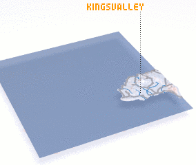 Places with similar names to Kings Valley, Jamaica ::
// Kingsville (US)
// Kongsvoll (NO)
// Kingsville (US)
// Kings Valley (US)
// Kingsville (US)
// Kingsville (US)
// Kingsville (US)
// Kings Valley (US)
// Kingsville (US)
// Kings Valley (US)
Disclaimer :: Information on this page comes without warranty of any kind |
||
|
Where is Kings Valley? Elevation and coordinates ::
Latitude (lat): 18°19'0"N Longitude (lon): 78°12'0"W
Elevation (approx.): 25m (map arrows pan, magnifying glasses zoom) |
||
|
Visiting Kings Valley? Hotel/Accommodation ::
Book a hotel in Kings Valley Travel Guide ::
Buy a travel guide for Jamaica rental cars ::
car rental offers GPS waypoint ::
download a GPX waypoint (PoI) of Kings Valley for your GPS receiver
|
||