|
search place name
|
||
Lluidas Vale (Saint Catherine, Jamaica)Lluidas Vale is a town in the Saint Catherine region of Jamaica. An overview map of the region around Lluidas Vale is displayed below.
regional and 3d topo map of Lluidas Vale, Jamaica ::

Lluidas Vale airports ::
The nearest airport is OCJ - Ocho Rios Boscobel, located 35.6 km north east of Lluidas Vale.
Other airports nearby include KTP - Kingston Tinson Pen (38.1 km south east), KIN - Kingston Norman Manley Intl (44.2 km south east), POT - Port Antonio Ken Jones (65.5 km east), MBJ - Montego Bay Sangster Intl (90.5 km north west), Nearby towns ::
Thetford (0.0km north) //
Swansea (1.9km north) //
Worthy Park (1.9km north) //
New York (2.6km south east) //
Orange Valley (3.5km west) //
Kentish (3.7km south) //
Wilbury (4.0km south west) //
The Alves (4.0km south west) //
Cool Spring (4.0km south east) //
Coco Ree (4.0km north west) //
Chatworth (5.1km south east) //
Fairfield (5.1km south east) //
Oxford (5.1km south east) //
Crofts Hill (5.6km west) //
British (5.6km west) //
Ludlow (5.6km west) //
Blue Mountain (5.8km north) //
Thetford Mountain (5.8km south) //
Riverhead (5.6km east) //
Lucky Valley (6.5km south west) //
Phelps Run (6.6km south west) //
Charlton (6.5km north east) //
Bellfield (7.4km south) //
Saint Johnʼs (7.4km north) //
Paradise (7.0km west) //
Williamsons (7.4km north) //
Connors (7.6km south) //
Mount Olive (7.6km south) //
Ginger Ridge (7.6km south) //
[all distances 'as the bird flies' and approximate] 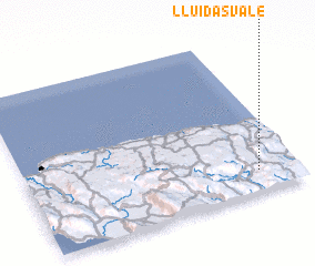 Places with similar names to Lluidas Vale, Jamaica ::
// Lettsville (US)
// Leetsville (US)
// Lutesville (US)
// Leedsville (US)
// Lloydsville (US)
// Lloydsville (US)
// Lloydsville (US)
// Lottsville (US)
// Lutzville (US)
// Lutzville (ZA)
Disclaimer :: Information on this page comes without warranty of any kind |
||
|
Where is Lluidas Vale? Elevation and coordinates ::
Latitude (lat): 18°8'0"N Longitude (lon): 77°9'0"W
Elevation (approx.): 382m (map arrows pan, magnifying glasses zoom) |
||
|
Visiting Lluidas Vale? Hotel/Accommodation ::
Book a hotel in Lluidas Vale Travel Guide ::
Buy a travel guide for Jamaica rental cars ::
car rental offers GPS waypoint ::
download a GPX waypoint (PoI) of Lluidas Vale for your GPS receiver
|
||