|
search place name
|
||
Maryfield (Saint Catherine, Jamaica)Maryfield is a town in the Saint Catherine region of Jamaica. An overview map of the region around Maryfield is displayed below.
regional and 3d topo map of Maryfield, Jamaica ::

Maryfield airports ::
The nearest airport is KTP - Kingston Tinson Pen, located 24.2 km east of Maryfield.
Other airports nearby include KIN - Kingston Norman Manley Intl (29.2 km east), OCJ - Ocho Rios Boscobel (43.7 km north), POT - Port Antonio Ken Jones (58.2 km east), MBJ - Montego Bay Sangster Intl (106.0 km north west), Nearby towns ::
Vaz Delight (0.0km north) //
Rosemount (0.0km north) //
Kitson Town (0.0km north) //
Sallys Delight (0.0km north) //
Dover (1.8km west) //
Frenchmans Hill (1.8km east) //
Content (1.8km west) //
The Rest (1.8km east) //
Edbury (2.6km north east) //
Bamboo Market (2.6km north west) //
Guanaboa Vale (2.6km north west) //
Emilie (2.6km north east) //
Dove Cot Park (3.5km east) //
Seven Doubloons (3.5km east) //
Hope (4.0km north east) //
Cudjoe Hill (4.1km north west) //
Spring Garden (4.1km south west) //
Innswood (4.1km south east) //
Envy Valley (4.1km south east) //
Belmont (5.1km north west) //
Bellevue Heights (5.1km south east) //
Waterloo (5.6km north) //
Mount Pleasant (5.6km west) //
Spring Village (5.8km south) //
Retreat (5.8km north) //
Tharp Pen (6.6km south west) //
Mendez Hill (6.6km north west) //
Montpelier (6.6km north west) //
Saint Helens (7.4km south) //
[all distances 'as the bird flies' and approximate] 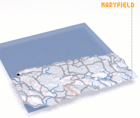 Places with similar names to Maryfield, Jamaica ::
// Moorefield (US)
// Murfeld (AT)
// Moorefield (US)
// Merfeld (DE)
// Moorfleet (DE)
// Moorefield (US)
// Merrifield (US)
// Moorefield (US)
// Merrifield (US)
// Merrifield (US)
Disclaimer :: Information on this page comes without warranty of any kind |
||
|
Where is Maryfield? Elevation and coordinates ::
Latitude (lat): 18°1'0"N Longitude (lon): 77°3'0"W
Elevation (approx.): 147m (map arrows pan, magnifying glasses zoom) |
||
|
Visiting Maryfield? Hotel/Accommodation ::
Book a hotel in Maryfield Travel Guide ::
Buy a travel guide for Jamaica rental cars ::
car rental offers GPS waypoint ::
download a GPX waypoint (PoI) of Maryfield for your GPS receiver
|
||