|
search place name
|
||
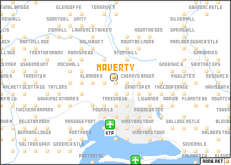
Maverty (Saint Andrew, Jamaica)Maverty is a town in the Saint Andrew region of Jamaica. An overview map of the region around Maverty is displayed below.
regional and 3d topo map of Maverty, Jamaica ::
Maverty airports ::
The nearest airport is KTP - Kingston Tinson Pen, located 6.8 km south of Maverty.
Other airports nearby include KIN - Kingston Norman Manley Intl (13.0 km south), POT - Port Antonio Ken Jones (34.1 km north east), OCJ - Ocho Rios Boscobel (42.4 km north), MBJ - Montego Bay Sangster Intl (126.4 km north west), Nearby towns ::
Tumbridge (0.0km north) //
Red Hills (1.8km west) //
Stirling Castle (1.8km west) //
Pembroke Hall (1.8km west) //
Kirklands (1.8km west) //
Glebe Farm (1.9km south) //
Constant Spring (1.8km east) //
Swallowfield (1.8km east) //
Smiths Pen (1.8km east) //
Pembroke Hall (1.9km south) //
Dunrobin (2.6km south east) //
Mary Browns Corner (2.6km south east) //
Charlton (2.6km south east) //
Slanmore (3.5km west) //
Tree Grove (3.7km south) //
Four Roads (3.7km south) //
Cherry Garden (3.5km east) //
Saint Christopher (4.1km north west) //
Olympic Gardens (4.1km south west) //
Fort George (4.1km north east) //
Mount Pleasant (4.1km north east) //
Stony Hill (4.1km north east) //
Eastwood Park (4.1km south east) //
Camperdown (4.1km south east) //
Cassia Park (4.1km south east) //
Grants Pen (4.0km south east) //
Arcadia Club (4.0km south east) //
Washington Gardens (5.1km south west) //
Six Miles (5.1km south west) //
[all distances 'as the bird flies' and approximate]  Places with similar names to Maverty, Jamaica ::
Disclaimer :: Information on this page comes without warranty of any kind |
||
|
Where is Maverty? Elevation and coordinates ::
Latitude (lat): 18°3'0"N Longitude (lon): 76°49'0"W
Elevation (approx.): 73m (map arrows pan, magnifying glasses zoom) |
||
|
Visiting Maverty? Hotel/Accommodation ::
Book a hotel in Maverty Travel Guide ::
Buy a travel guide for Jamaica rental cars ::
car rental offers GPS waypoint ::
download a GPX waypoint (PoI) of Maverty for your GPS receiver
|
||