|
search place name
|
||
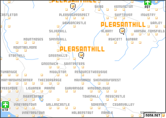
Pleasant Hill (Saint Andrew, Jamaica)Pleasant Hill is a town in the Saint Andrew region of Jamaica. An overview map of the region around Pleasant Hill is displayed below.
regional and 3d topo map of Pleasant Hill, Jamaica ::
Pleasant Hill airports ::
The nearest airport is POT - Port Antonio Ken Jones, located 18.9 km north east of Pleasant Hill.
Other airports nearby include KTP - Kingston Tinson Pen (19.7 km south west), KIN - Kingston Norman Manley Intl (20.8 km south west), OCJ - Ocho Rios Boscobel (47.8 km north west), MBJ - Montego Bay Sangster Intl (139.8 km west), Nearby towns ::
Clydesdale (1.9km south) //
Chestervale (1.9km south) //
Spa Spring (1.8km west) //
Saint Peterʼs (2.6km south west) //
Resource (3.7km south) //
Halls Delight (3.7km south) //
Marlborough Castle (4.0km north west) //
Lebanon (5.1km south west) //
Content (5.1km south west) //
Tweedside (5.1km south east) //
Mavis Bank (5.6km south) //
Green Hills (5.3km west) //
Castle Dawson (5.3km west) //
Newcastle (5.6km west) //
Cascade (5.6km west) //
Cedar Valley (5.6km west) //
Hopewell (6.5km south west) //
Craigton (6.5km south west) //
Middleton (6.5km south west) //
Irish Town (6.5km south west) //
Farm Hill (6.6km south east) //
Chesterfield (6.6km south east) //
Spring Hill (6.5km north west) //
Smithfield (6.5km north west) //
Guava Ridge (7.6km south) //
Greenwich (7.3km west) //
Mount Charles (7.6km south) //
Mocho House (7.6km south) //
Dawson Castle (7.6km north) //
[all distances 'as the bird flies' and approximate]  Places with similar names to Pleasant Hill, Jamaica ::
// Pleasant Hill (US)
// Pleasant Hill (US)
// Pleasant Hill (US)
// Pleasant Hill (US)
// Pleasant Hill (US)
// Pleasant Hill (US)
// Pleasant Hill (US)
// Pleasant Hill (US)
// Pleasant Hill (US)
// Pleasant Hill (US)
Disclaimer :: Information on this page comes without warranty of any kind |
||
|
Where is Pleasant Hill? Elevation and coordinates ::
Latitude (lat): 18°5'0"N Longitude (lon): 76°40'0"W
Elevation (approx.): 1151m (map arrows pan, magnifying glasses zoom) |
||
|
Visiting Pleasant Hill? Hotel/Accommodation ::
Book a hotel in Pleasant Hill Travel Guide ::
Buy a travel guide for Jamaica rental cars ::
car rental offers GPS waypoint ::
download a GPX waypoint (PoI) of Pleasant Hill for your GPS receiver
|
||