|
search place name
|
||
Williamsfield (Manchester, Jamaica)Williamsfield is a town in the Manchester region of Jamaica. An overview map of the region around Williamsfield is displayed below.
regional and 3d topo map of Williamsfield, Jamaica ::

Williamsfield airports ::
The nearest airport is OCJ - Ocho Rios Boscobel, located 64.5 km north east of Williamsfield.
Other airports nearby include MBJ - Montego Bay Sangster Intl (67.6 km north west), KTP - Kingston Tinson Pen (68.6 km east), KIN - Kingston Norman Manley Intl (73.4 km east), POT - Port Antonio Ken Jones (99.7 km east), Nearby towns ::
Hanbury (1.8km west) //
Shooters Hill (1.9km north) //
Content (1.9km south) //
Royal Flat (1.9km south) //
Bellefield (1.8km east) //
Davyton (1.8km east) //
Kendal (2.6km north west) //
Thorn Hill (2.6km south west) //
Caledonia (2.6km south west) //
Hope (2.6km south east) //
Virginia (3.7km north) //
Barossa (3.7km south) //
Mount Nelson (3.7km south) //
Newhall (3.7km south) //
Blue Mountain (3.5km east) //
Banana Ground (3.5km east) //
Belleair (4.1km north east) //
Browns Town (4.1km south east) //
Arcadia (4.0km south east) //
Stricklands (4.0km south east) //
Mandeville (5.1km south west) //
Saint Helena (5.1km north east) //
Redbury (5.1km south east) //
Belle Retiro (5.6km south) //
Lochaber (5.6km south) //
Richmond (5.6km south) //
Roxborough (5.6km south) //
Berwick (5.8km south) //
Walderston (5.8km north) //
[all distances 'as the bird flies' and approximate] 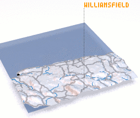 Places with similar names to Williamsfield, Jamaica ::
// Williamsfield (US)
// Willmsfeld (DE)
// Williamsfield (US)
// Williamsfield (JM)
// Williamsfield (JM)
// Williamsfield (JM)
// Williamsfield (JM)
// Williamsfield (JM)
// Williamsfield (JM)
// Williamsfield (JM)
Disclaimer :: Information on this page comes without warranty of any kind |
||
|
Where is Williamsfield? Elevation and coordinates ::
Latitude (lat): 18°4'0"N Longitude (lon): 77°28'0"W
Elevation (approx.): 427m (map arrows pan, magnifying glasses zoom) |
||
|
Visiting Williamsfield? Hotel/Accommodation ::
Book a hotel in Williamsfield Travel Guide ::
Buy a travel guide for Jamaica rental cars ::
car rental offers GPS waypoint ::
download a GPX waypoint (PoI) of Williamsfield for your GPS receiver
|
||