|
search place name
|
||
Williams Town (Saint Mary, Jamaica)Williams Town is a town in the Saint Mary region of Jamaica. An overview map of the region around Williams Town is displayed below.
regional and 3d topo map of Williams Town, Jamaica ::

Williams Town airports ::
The nearest airport is OCJ - Ocho Rios Boscobel, located 13.4 km north of Williams Town.
Other airports nearby include KTP - Kingston Tinson Pen (36.0 km south east), KIN - Kingston Norman Manley Intl (42.9 km south east), POT - Port Antonio Ken Jones (46.7 km east), MBJ - Montego Bay Sangster Intl (103.0 km west), Nearby towns ::
Decoy Estate (1.8km west) //
Old Barracks (2.6km north west) //
Pembroke Hall (2.6km north west) //
Change Hill (2.6km south east) //
Springfield (3.7km south) //
Marley (3.7km north) //
Berry Hill (3.5km east) //
Wallingford (4.0km south west) //
Decoy Pen (4.1km south west) //
Arcadia (4.1km south west) //
Windsor Castle (4.1km south east) //
Palmetto Grove (4.0km south east) //
Carron Hall (4.0km south east) //
Brae Head (4.0km south east) //
Bonny Gate (4.1km north east) //
Bishop Mount (4.1km north east) //
Crawle (4.0km north east) //
Comfort Settlement (4.0km north east) //
Guys Hill (5.1km south west) //
Woodside (5.1km south east) //
Pear Tree Grove (5.1km south east) //
Top Hill (5.1km north east) //
Boyne Park (5.1km north east) //
Jeffrey Town (5.3km west) //
Golden Grove (5.6km south) //
Blackstone Edge (5.6km west) //
Dressikie (5.8km north) //
Salisbury (5.6km west) //
Elgin Town (5.6km west) //
[all distances 'as the bird flies' and approximate] 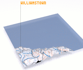 Places with similar names to Williams Town, Jamaica ::
// Williamstown (US)
// Williamstown (US)
// Williamstown (US)
// Williamstown (US)
// Williamstown (US)
// Williamstown (US)
// Williamstown (US)
// Williamstown (US)
// Williamston (US)
// Williamstown (US)
Disclaimer :: Information on this page comes without warranty of any kind |
||
|
Where is Williams Town? Elevation and coordinates ::
Latitude (lat): 18°17'0"N Longitude (lon): 76°58'0"W
Elevation (approx.): 379m (map arrows pan, magnifying glasses zoom) |
||
|
Visiting Williams Town? Hotel/Accommodation ::
Book a hotel in Williams Town Travel Guide ::
Buy a travel guide for Jamaica rental cars ::
car rental offers GPS waypoint ::
download a GPX waypoint (PoI) of Williams Town for your GPS receiver
|
||