|
search place name
|
||
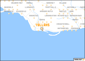
Yallahs (Saint Thomas, Jamaica)Yallahs is a town in the Saint Thomas region of Jamaica. An overview map of the region around Yallahs is displayed below.
regional and 3d topo map of Yallahs, Jamaica ::
Yallahs airports ::
The nearest airport is KIN - Kingston Norman Manley Intl, located 24.6 km west of Yallahs.
Other airports nearby include KTP - Kingston Tinson Pen (30.4 km north west), POT - Port Antonio Ken Jones (36.9 km north), OCJ - Ocho Rios Boscobel (73.2 km north west), MBJ - Montego Bay Sangster Intl (159.0 km north west), Nearby towns ::
Mount Olive (0.0km north) //
Lloyds Pen (1.8km west) //
Heart Ease (2.6km north west) //
Parsonage (2.6km north west) //
Norris (3.7km north) //
Albion (4.0km north west) //
Poor Mans Corner (4.0km north west) //
Edinburgh Castle (4.1km north west) //
Lloyds (4.1km north east) //
Aeolus Valley (5.1km north east) //
Easington (6.6km north west) //
Lows Mountain (6.6km north east) //
Windsor Castle (7.6km north) //
Font Hill (10.2km north east) //
[all distances 'as the bird flies' and approximate] 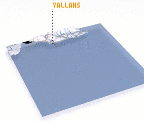 Places with similar names to Yallahs, Jamaica ::
Disclaimer :: Information on this page comes without warranty of any kind |
||
|
Where is Yallahs? Elevation and coordinates ::
Latitude (lat): 17°52'0"N Longitude (lon): 76°34'0"W
Elevation (approx.): -32768m (map arrows pan, magnifying glasses zoom) |
||
|
Visiting Yallahs? Hotel/Accommodation ::
Book a hotel in Yallahs Travel Guide ::
Buy a travel guide for Jamaica rental cars ::
car rental offers GPS waypoint ::
download a GPX waypoint (PoI) of Yallahs for your GPS receiver
|
||