|
search place name
|
||
Ban Bèngthong (Houaphan, Laos)Ban Bèngthong is a town in the Houaphan region of Laos. An overview map of the region around Ban Bèngthong is displayed below.
regional and 3d topo map of Ban Bèngthong, Laos ::

Ban Bèngthong airports ::
The nearest airport is LPQ - Luang Prabang Luang Phabang Intl, located 141.6 km south west of Ban Bèngthong.
Nearby towns ::
Ban Chak (3.8km north west) //
Ban That (4.5km north west) //
Ban Sôp-Ong (4.9km north) //
Ban Lèng (5.4km west) //
Ban Vat (5.9km north west) //
Ban Phônxong (6.7km south) //
Ban Nanom (6.6km north west) //
Ban Houayma-Nua (7.6km north east) //
Ban Namchiat (7.7km north east) //
Ban Phapét (8.3km north) //
Ban Xop-Nua (8.3km north west) //
Ban Xop-Tai (9.8km north west) //
[all distances 'as the bird flies' and approximate] 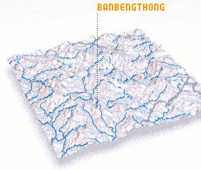 Places with similar names to Ban Bèngthong, Laos ::
Disclaimer :: Information on this page comes without warranty of any kind |
||
|
Where is Ban Bèngthong? Elevation and coordinates ::
Latitude (lat): 20°24'30"N Longitude (lon): 103°24'8"E
Elevation (approx.): 919m (map arrows pan, magnifying glasses zoom) |
||
|
Visiting Ban Bèngthong? Hotel/Accommodation ::
Book a hotel in Ban Bèngthong Travel Guide ::
Buy a travel guide for Laos rental cars ::
car rental offers GPS waypoint ::
download a GPX waypoint (PoI) of Ban Bèngthong for your GPS receiver
|
||