|
search place name
|
||
Ban Houamuang (Louangphrabang, Laos)Ban Houamuang is a town in the Louangphrabang region of Laos. An overview map of the region around Ban Houamuang is displayed below.
regional and 3d topo map of Ban Houamuang, Laos ::

Ban Houamuang airports ::
The nearest airport is LPQ - Luang Prabang Luang Phabang Intl, located 51.8 km west of Ban Houamuang.
Other airports nearby include VTE - Vientiane Wattay Intl (220.2 km south), Nearby towns ::
Ban Phak-Hôk (2.7km east) //
Ban Houaydang (2.9km south) //
Ban Sôpché (3.2km west) //
Ban Môkchaloy (3.7km south east) //
Ban Naxai (4.5km north east) //
Ban Houaypôt (4.8km north west) //
Ban Houaysignoua (4.8km west) //
Ban Phoubout (5.5km north east) //
Ban Vanglôm (5.7km west) //
Ban Houayloung-Nua (6.1km south west) //
Ban Nong-Ôn (6.2km west) //
Ban Phakbông (7.1km east) //
Ban Chombang (7.5km south) //
Ban Khaokôk (7.5km north west) //
Ban Houaydong (8.2km south) //
Ban Tia (8.5km north west) //
Ban Houaytamang (8.9km north east) //
Ban Môkhang (9.1km north east) //
Ban Choumkham (9.3km north east) //
Ban Sèn Vong (9.5km south west) //
Ban Houayloung-Tai (10.1km south west) //
Ban Longlachiang (10.9km south east) //
[all distances 'as the bird flies' and approximate] 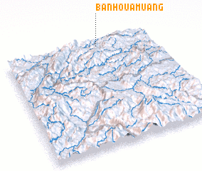 Places with similar names to Ban Houamuang, Laos ::
// Ban Huai Meng (TH)
// Ban Huai Muang (TH)
// Ban Huai Muang (TH)
// Ban Huai Muang (TH)
// Ban Huai Muang (TH)
// Ban Huai Muang (TH)
// Ban Huai Muang (TH)
// Ban Huai Muang (TH)
// Ban Huai Muang (TH)
// Ban Huai Muang (TH)
Disclaimer :: Information on this page comes without warranty of any kind |
||
|
Where is Ban Houamuang? Elevation and coordinates ::
Latitude (lat): 19°58'33"N Longitude (lon): 102°38'56"E
Elevation (approx.): 1015m (map arrows pan, magnifying glasses zoom) |
||
|
Visiting Ban Houamuang? Hotel/Accommodation ::
Book a hotel in Ban Houamuang Travel Guide ::
Buy a travel guide for Laos rental cars ::
car rental offers GPS waypoint ::
download a GPX waypoint (PoI) of Ban Houamuang for your GPS receiver
|
||