|
search place name
|
||
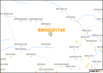
Ban Houaytha (Laos)Ban Houaytha is a town in Laos. An overview map of the region around Ban Houaytha is displayed below.
regional and 3d topo map of Ban Houaytha, Laos ::
Ban Houaytha airports ::
The nearest airport is ZVK - Savannakhet, located 145.3 km south west of Ban Houaytha.
Other airports nearby include SNO - Sakon Nakhon (196.6 km west), Nearby towns ::
Ban Nalouang Nua (2.6km north west) //
Ban Saeum (4.1km north west) //
Ban Kang (1) (4.1km south west) //
Ban Houaykha (7.7km north west) //
Ban Pakhiat (9.0km north west) //
Ban Tong (9.3km north east) //
Ban Katok (9.3km south east) //
Ban Kang (2) (10.3km south west) //
Ban Houaypa (11.8km south east) //
[all distances 'as the bird flies' and approximate] 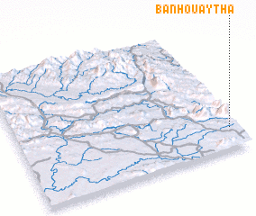 Places with similar names to Ban Houaytha, Laos ::
// Ban Hat Hae (TH)
// Ban Hat Hae (TH)
// Ban Huai Thi (TH)
// Ban Hua Tha (TH)
// Ban Hat-Hai (LA)
// Ban Hat-Hè (LA)
// Ban Hat-Houay (LA)
// Ban Houaytha (LA)
// Ban Houaytha (LA)
// Ban Houay Thao (LA)
Disclaimer :: Information on this page comes without warranty of any kind |
||
|
Where is Ban Houaytha? Elevation and coordinates ::
Latitude (lat): 17°10'0"N Longitude (lon): 105°58'0"E
Elevation (approx.): 345m (map arrows pan, magnifying glasses zoom) |
||
|
Visiting Ban Houaytha? Hotel/Accommodation ::
Book a hotel in Ban Houaytha Travel Guide ::
Buy a travel guide for Laos rental cars ::
car rental offers GPS waypoint ::
download a GPX waypoint (PoI) of Ban Houaytha for your GPS receiver
|
||