|
search place name
|
||
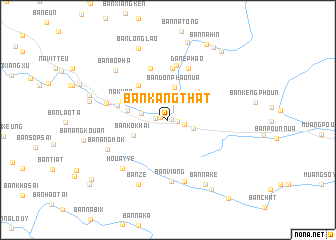
Ban Kangthat (Houaphan, Laos)Ban Kangthat is a town in the Houaphan region of Laos. An overview map of the region around Ban Kangthat is displayed below.
regional and 3d topo map of Ban Kangthat, Laos ::
Ban Kangthat airports ::
The nearest airport is HAN - Hanoi Noibai Intl, located 178.3 km north east of Ban Kangthat.
Nearby towns ::
Ban Kangmuang (0.4km east) //
Ban Nahoa (0.8km west) //
Ban Sômpoy (1.0km east) //
Na Sane (1.3km west) //
Ban Kangmông (1.7km east) //
Ban Kangpabông (2.9km east) //
Ban Kho (2.9km west) //
Ban Houay Lai (3.0km north east) //
Ban Bokay (3.3km north west) //
Ban Donphao-Nua (3.7km north) //
Houa Thông (3.7km north west) //
Ban Kokhai (4.0km south west) //
Ban Xiangmèn (4.3km west) //
Ban Houayxai (4.5km north east) //
Ban O Lai (4.4km north east) //
Ban Bo Pha Teu (4.9km north west) //
Na Khao (5.2km north west) //
Ban Nong (5.8km north) //
Ban Nahia-Mai (5.5km west) //
Ban Phiangliang (6.1km north) //
Dane Phao (6.1km north) //
Ban Phao-Tai (6.2km north) //
Ban Viang (6.9km south) //
Ban Poung (6.7km west) //
Ban Mông (7.1km south) //
Houay Ye (7.2km south west) //
Ban Angmok (7.1km south west) //
Ban Zè (7.8km south west) //
Ban Bopha (7.7km north west) //
[all distances 'as the bird flies' and approximate] 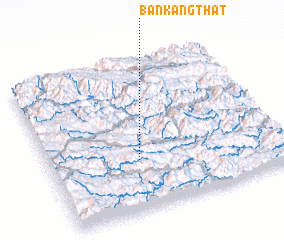 Places with similar names to Ban Kangthat, Laos :: Disclaimer :: Information on this page comes without warranty of any kind |
||
|
Where is Ban Kangthat? Elevation and coordinates ::
Latitude (lat): 20°19'54"N Longitude (lon): 104°22'45"E
Elevation (approx.): 671m (map arrows pan, magnifying glasses zoom) |
||
|
Visiting Ban Kangthat? Hotel/Accommodation ::
Book a hotel in Ban Kangthat Travel Guide ::
Buy a travel guide for Laos rental cars ::
car rental offers GPS waypoint ::
download a GPX waypoint (PoI) of Ban Kangthat for your GPS receiver
|
||