|
search place name
|
||
Ban Kasék (Laos)Ban Kasék is a town in Laos. An overview map of the region around Ban Kasék is displayed below.
regional and 3d topo map of Ban Kasék, Laos ::

Ban Kasék airports ::
The nearest airport is ZVK - Savannakhet, located 16.8 km west of Ban Kasék.
Other airports nearby include SNO - Sakon Nakhon (109.9 km north west), PKZ - Pakse (183.8 km south east), Nearby towns ::
Ban Hatnadi (0.0km north) //
Ban Xông (2.6km north east) //
Ban Phônsim (4.0km north west) //
Ban Xokvang (5.1km south east) //
Ban Sômsaat (5.1km south east) //
Ban Gnangsoung (5.3km west) //
Ban Houay (5.6km west) //
Ban That (6.5km north west) //
Ban Nakoy (7.1km east) //
Ban Phônsoung (7.1km west) //
Ban Dongmakyang (7.3km west) //
Ban Xok (7.3km west) //
Sala (7.7km south east) //
Ban Khôk (8.0km north east) //
Soc Ouan (9.0km south east) //
[all distances 'as the bird flies' and approximate] 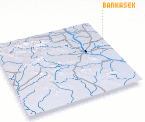 Places with similar names to Ban Kasék, Laos ::
// Bonkiškė (LT)
// Buynaksk (RU)
// Bangassoko (BF)
// Bangozougou (BF)
// Bancahsaga (ID)
// Bankassouk (SN)
// Ban Naxay (2) (LA)
// Ban Naxôk (LA)
// Ban Naxouak (LA)
// Ban Naxuak (LA)
Disclaimer :: Information on this page comes without warranty of any kind |
||
|
Where is Ban Kasék? Elevation and coordinates ::
Latitude (lat): 16°34'0"N Longitude (lon): 104°55'0"E
Elevation (approx.): 158m (map arrows pan, magnifying glasses zoom) |
||
|
Visiting Ban Kasék? Hotel/Accommodation ::
Book a hotel in Ban Kasék Travel Guide ::
Buy a travel guide for Laos rental cars ::
car rental offers GPS waypoint ::
download a GPX waypoint (PoI) of Ban Kasék for your GPS receiver
|
||