|
search place name
|
||
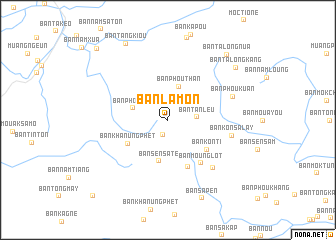
Ban Lamon (Louangnamtha, Laos)Ban Lamon is a town in the Louangnamtha region of Laos. An overview map of the region around Ban Lamon is displayed below.
regional and 3d topo map of Ban Lamon, Laos ::
Ban Lamon airports ::
The nearest airport is LPQ - Luang Prabang Luang Phabang Intl, located 123.4 km south east of Ban Lamon.
Other airports nearby include THL - Tachilek Tachileik (131.0 km west), KET - Kengtung (182.7 km north west), MOG - Mong Hsat (201.7 km west), Nearby towns ::
Ban Khonthou (1.8km south) //
Ban Tanleu (3.0km east) //
Ban Phouthan (3.9km north) //
Ban Phoubèk (3.8km west) //
Ban Sènsatè (4.7km south) //
Ban Khanungphèt (4.9km south west) //
Ban Konti (5.3km south east) //
Ban Môngkalay (5.7km south) //
Ban Mounglot (5.9km south east) //
Ban Konsalay (6.9km east) //
Ban Sapout (7.2km south east) //
Ban Phoukuan (7.2km east) //
Ban Sapèn (9.4km south) //
Ban Talong-Kang (9.2km north east) //
Ban Tangkiou (9.6km north west) //
Ban Talông-Nua (9.5km north east) //
Ban Phoulèk (10.9km north west) //
Ban Laignong (11.6km south west) //
[all distances 'as the bird flies' and approximate]  Places with similar names to Ban Lamon, Laos ::
// Ban Laem Manao (TH)
// Ban Laem No (TH)
// Ban Laem Uan (TH)
// Ban Lam Baen (TH)
// Ban Lam Nao (TH)
// Ban Lao Manao (TH)
// Ban Lao Manao (TH)
// Ban Lum Bon (TH)
// Banlamen (CN)
Disclaimer :: Information on this page comes without warranty of any kind |
||
|
Where is Ban Lamon? Elevation and coordinates ::
Latitude (lat): 20°32'0"N Longitude (lon): 101°11'25"E
Elevation (approx.): 1158m (map arrows pan, magnifying glasses zoom) |
||
|
Visiting Ban Lamon? Hotel/Accommodation ::
Book a hotel in Ban Lamon Travel Guide ::
Buy a travel guide for Laos rental cars ::
car rental offers GPS waypoint ::
download a GPX waypoint (PoI) of Ban Lamon for your GPS receiver
|
||