|
search place name
|
||
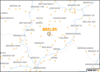
Ban Lan (Laos)Ban Lan is a town in Laos. An overview map of the region around Ban Lan is displayed below.
regional and 3d topo map of Ban Lan, Laos ::
Ban Lan airports ::
The nearest airport is LPQ - Luang Prabang Luang Phabang Intl, located 98.9 km south of Ban Lan.
Nearby towns ::
Ban Kioukôk (0.8km north east) //
Sènmang (1.9km north) //
Sèncham (2.5km south east) //
Ban Sônkhoua (3.2km east) //
Ban Houayliang (3.2km west) //
Ban Houayxou (3.4km south) //
Ban Phanongpo (3.4km north east) //
Ban Louangmiang (4.3km north) //
Ban Phônxai (4.4km east) //
Bouak-Hét (5.1km south west) //
Nam Kut (5.1km north west) //
Ban Lak-Ha (5.4km south) //
Ban San (5.6km north) //
Sala Pangxang (5.2km east) //
Sala Môk (5.5km east) //
Ban San (5.8km north) //
Ban Mai (6.6km south east) //
Kui Lak (6.6km north west) //
Lakongmouan (6.6km north east) //
Ban Kat (6.6km south east) //
Ban Donxai (7.1km south) //
Ban Yang (6.7km west) //
Ban Nabo-Gnai (7.3km south) //
Ban Houayla (7.0km north east) //
Ban Fèn (7.3km south) //
Ban Phiangxai (7.0km north west) //
Ban Kounglang (7.9km north) //
Ban Saloungkoang-Tai (8.1km north west) //
Ban Nabo Noy (8.7km south) //
[all distances 'as the bird flies' and approximate] 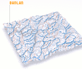 Places with similar names to Ban Lan, Laos ::
Disclaimer :: Information on this page comes without warranty of any kind |
||
|
Where is Ban Lan? Elevation and coordinates ::
Latitude (lat): 20°47'0"N Longitude (lon): 102°2'0"E
Elevation (approx.): 979m (map arrows pan, magnifying glasses zoom) |
||
|
Visiting Ban Lan? Hotel/Accommodation ::
Book a hotel in Ban Lan Travel Guide ::
Buy a travel guide for Laos rental cars ::
car rental offers GPS waypoint ::
download a GPX waypoint (PoI) of Ban Lan for your GPS receiver
|
||