|
search place name
|
||
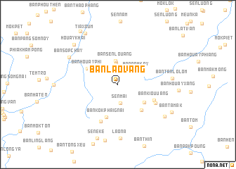
Ban Laovang (Oudômxai, Laos)Ban Laovang is a town in the Oudômxai region of Laos. An overview map of the region around Ban Laovang is displayed below.
regional and 3d topo map of Ban Laovang, Laos ::
Ban Laovang airports ::
The nearest airport is LPQ - Luang Prabang Luang Phabang Intl, located 112.8 km south of Ban Laovang.
Nearby towns ::
Sen Mai (3.0km south) //
Ban Anô-Gnai (3.4km north) //
Ban Namkay (3.5km north east) //
Ban Sènlouang (3.8km north) //
Ban Môk-Lahang (4.8km south east) //
Ban Kôkphai-Gnai (5.5km south) //
Ban Houayphi (5.2km north west) //
Ban Houaytôn (5.4km south east) //
Ban Kiou-Uang (5.9km south east) //
Ban Akang (6.4km south west) //
Ban Pong Lai (6.3km south east) //
Lao Na (8.6km south) //
Ban Tanlôlôm (8.1km east) //
Ban Sôpchay (8.4km north west) //
Ban Kiouthoung (8.6km south east) //
Seneke (9.1km south) //
Houay Khai (9.1km north west) //
Tiaxoum (9.4km north west) //
Ban Tamak (9.1km south east) //
Ban Houakèng (10.1km north west) //
[all distances 'as the bird flies' and approximate]  Places with similar names to Ban Laovang, Laos ::
Disclaimer :: Information on this page comes without warranty of any kind |
||
|
Where is Ban Laovang? Elevation and coordinates ::
Latitude (lat): 20°54'37"N Longitude (lon): 102°16'47"E
Elevation (approx.): 1219m (map arrows pan, magnifying glasses zoom) |
||
|
Visiting Ban Laovang? Hotel/Accommodation ::
Book a hotel in Ban Laovang Travel Guide ::
Buy a travel guide for Laos rental cars ::
car rental offers GPS waypoint ::
download a GPX waypoint (PoI) of Ban Laovang for your GPS receiver
|
||