|
search place name
|
||
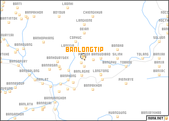
Ban Longtip (Houaphan, Laos)Ban Longtip is a town in the Houaphan region of Laos. An overview map of the region around Ban Longtip is displayed below.
regional and 3d topo map of Ban Longtip, Laos ::
Ban Longtip airports ::
The nearest airport is HAN - Hanoi Noibai Intl, located 149.9 km east of Ban Longtip.
Nearby towns ::
Pac Hom (0.5km north) //
Ban Pahôk (0.9km south west) //
Tong Long (1.3km south) //
Ban Phalong (1.8km east) //
Ban Lagmè (3.3km south) //
Ban Suoi Bao (3.4km east) //
Ban Houayngeum (2) (4.0km south west) //
Làng Gia (4.3km north west) //
Cô Phúc (4.6km north west) //
Ban Mon (4.6km south east) //
Long Tong (4.7km south east) //
Ban Naliou (5.3km south west) //
Ban Phong (5.5km south west) //
Bang Phu (5.3km east) //
Ban Houayngeum (1) (5.4km west) //
Ban Pahang (5.6km south east) //
Suoi Lap (5.4km west) //
Ban Houaydék (5.6km west) //
Oé Ian (6.1km north) //
Buc Tu (6.1km north) //
Ban Longtong (6.7km south) //
Ban Pakhôm (6.7km south) //
Si Linh (6.9km east) //
Ban Pong (7.3km south west) //
Ban Napung (7.2km south west) //
Bản A Ma (7.3km east) //
Làng Ke Re (7.9km north) //
Ban Nasan (7.5km west) //
Ban Na Chomlom (8.7km south west) //
[all distances 'as the bird flies' and approximate] 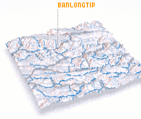 Places with similar names to Ban Longtip, Laos :: Disclaimer :: Information on this page comes without warranty of any kind |
||
|
Where is Ban Longtip? Elevation and coordinates ::
Latitude (lat): 20°45'43"N Longitude (lon): 104°27'2"E
Elevation (approx.): 1062m (map arrows pan, magnifying glasses zoom) |
||
|
Visiting Ban Longtip? Hotel/Accommodation ::
Book a hotel in Ban Longtip Travel Guide ::
Buy a travel guide for Laos rental cars ::
car rental offers GPS waypoint ::
download a GPX waypoint (PoI) of Ban Longtip for your GPS receiver
|
||