|
search place name
|
||
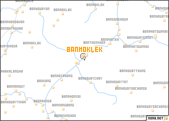
Ban Môklék (Louangphrabang, Laos)Ban Môklék is a town in the Louangphrabang region of Laos. An overview map of the region around Ban Môklék is displayed below.
regional and 3d topo map of Ban Môklék, Laos ::
Ban Môklék airports ::
The nearest airport is LPQ - Luang Prabang Luang Phabang Intl, located 69.8 km south west of Ban Môklék.
Nearby towns ::
Ban Nongkham (1.3km north east) //
Ban Khonkeung (1.5km south west) //
Ban Pakchim (1.8km west) //
Ban Pakngom (2.6km north east) //
Ban Sisaat (3.5km north east) //
Ban Thènkhèn (3.7km north east) //
Ban Houaychay (5.0km south) //
Ban Hatphang (6.4km south west) //
Ban Phatèm (6.4km north east) //
Ban Houaytat (8.8km south east) //
Ban Hatkhip (8.9km south west) //
Ban Lat-En (9.2km north east) //
Ban Houayhang (9.9km north east) //
Ban Houayveu-Gnai (10.2km north west) //
Ban Donkhoun (10.7km north east) //
[all distances 'as the bird flies' and approximate] 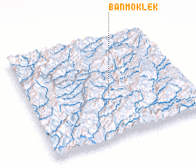 Places with similar names to Ban Môklék, Laos ::
// Ban Maklua Kao (TH)
// Ban Mok Lok (TH)
// Ban Muak Lek (TH)
// Ban Môklak (LA)
// Ban Môklak (LA)
// Ban Môklak (LA)
// Ban Môk-Loy (2) (LA)
Disclaimer :: Information on this page comes without warranty of any kind |
||
|
Where is Ban Môklék? Elevation and coordinates ::
Latitude (lat): 20°26'11"N Longitude (lon): 102°30'28"E
Elevation (approx.): 343m (map arrows pan, magnifying glasses zoom) |
||
|
Visiting Ban Môklék? Hotel/Accommodation ::
Book a hotel in Ban Môklék Travel Guide ::
Buy a travel guide for Laos rental cars ::
car rental offers GPS waypoint ::
download a GPX waypoint (PoI) of Ban Môklék for your GPS receiver
|
||