|
search place name
|
||
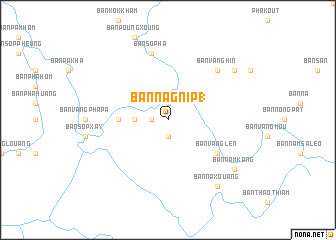
Ban Nagnip (1) (Laos)Ban Nagnip (1) is a town in Laos. An overview map of the region around Ban Nagnip (1) is displayed below.
regional and 3d topo map of Ban Nagnip (1), Laos ::
Ban Nagnip (1) airports ::
The nearest airport is SNO - Sakon Nakhon, located 146.4 km south of Ban Nagnip (1).
Other airports nearby include VTE - Vientiane Wattay Intl (205.2 km west), UTH - Udon Thani (212.4 km south west), ZVK - Savannakhet (216.0 km south), Nearby towns ::
Ban Nagnip (2) (1.9km south) //
Ban Pamak (1.8km west) //
Ban Ta Re (1.9km north) //
Ban Songkhon (3.5km west) //
Ban Kèng-Louang (5.3km west) //
Ban Vanglèn (6.4km south east) //
Ban Sôp-Ha (7.6km north) //
Ban Vanghin (7.7km north east) //
Ban Naxouang (9.1km south east) //
Ban Nam Yang (9.0km north east) //
Ban Namkang (9.0km south east) //
[all distances 'as the bird flies' and approximate] 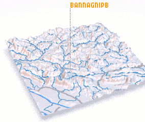 Places with similar names to Ban Nagnip (1), Laos :: Disclaimer :: Information on this page comes without warranty of any kind |
||
|
Where is Ban Nagnip (1)? Elevation and coordinates ::
Latitude (lat): 18°29'0"N Longitude (lon): 104°26'0"E
Elevation (approx.): 400m (map arrows pan, magnifying glasses zoom) |
||
|
Visiting Ban Nagnip (1)? Hotel/Accommodation ::
Book a hotel in Ban Nagnip (1) Travel Guide ::
Buy a travel guide for Laos rental cars ::
car rental offers GPS waypoint ::
download a GPX waypoint (PoI) of Ban Nagnip (1) for your GPS receiver
|
||