|
search place name
|
||
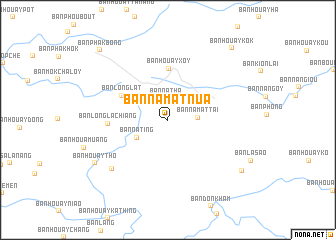
Ban Namat-Nua (Louangphrabang, Laos)Ban Namat-Nua is a town in the Louangphrabang region of Laos. An overview map of the region around Ban Namat-Nua is displayed below.
regional and 3d topo map of Ban Namat-Nua, Laos ::
Ban Namat-Nua airports ::
The nearest airport is LPQ - Luang Prabang Luang Phabang Intl, located 65.3 km west of Ban Namat-Nua.
Other airports nearby include VTE - Vientiane Wattay Intl (214.1 km south), Nearby towns ::
Ban Natha (2.4km north) //
Ban Namat-Tai (3.1km east) //
Ban Nating (3.8km south west) //
Ban Houaymiang (4.2km north east) //
Ban Houayxoy (5.7km north) //
Ban Longlat (5.6km north west) //
Ban Longlachiang (6.3km west) //
Ban Naphiang (8.0km south west) //
Ban Houaythô (9.0km south west) //
Ban Phopao (9.6km south east) //
Ban Houaykôk (10.4km north east) //
Ban Phakbông (10.6km north west) //
[all distances 'as the bird flies' and approximate]  Places with similar names to Ban Namat-Nua, Laos ::
// Binghamtown (US)
// Binghamton (US)
// Ban Madan (TH)
// Ban Mae Ta Nai (TH)
// Ban Mae Tan Nua (TH)
// Ban Mae Ta Noi (TH)
// Ban Mae Ten (TH)
// Ban Mae Toen (TH)
// Ban Mae Tun (TH)
// Ban Mae Tun (TH)
Disclaimer :: Information on this page comes without warranty of any kind |
||
|
Where is Ban Namat-Nua? Elevation and coordinates ::
Latitude (lat): 19°54'41"N Longitude (lon): 102°47'3"E
Elevation (approx.): 1097m (map arrows pan, magnifying glasses zoom) |
||
|
Visiting Ban Namat-Nua? Hotel/Accommodation ::
Book a hotel in Ban Namat-Nua Travel Guide ::
Buy a travel guide for Laos rental cars ::
car rental offers GPS waypoint ::
download a GPX waypoint (PoI) of Ban Namat-Nua for your GPS receiver
|
||