|
search place name
|
||
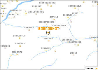
Ban Namhoy (Bokéo, Laos)Ban Namhoy is a town in the Bokéo region of Laos. An overview map of the region around Ban Namhoy is displayed below.
regional and 3d topo map of Ban Namhoy, Laos ::
Ban Namhoy airports ::
The nearest airport is THL - Tachilek Tachileik, located 51.9 km south west of Ban Namhoy.
Other airports nearby include KET - Kengtung (105.6 km north west), MOG - Mong Hsat (119.6 km west), LPQ - Luang Prabang Luang Phabang Intl (203.3 km south east), Nearby towns ::
Ban Chado (2.2km south) //
Ban Muanghoung (4.2km north) //
Ban Namkhayao (4.7km north east) //
Ban Ayngai (6.0km south) //
Ban Tolo (6.3km north) //
Ban Aychaí (6.5km south) //
Ban Namkhali (7.3km east) //
Ban Veupó (7.4km west) //
Ban Sènphonuang (9.3km north west) //
Ban Meung (9.5km north east) //
Muang Meung (9.5km north east) //
Ban Muangkang-Nua (9.4km north east) //
[all distances 'as the bird flies' and approximate] 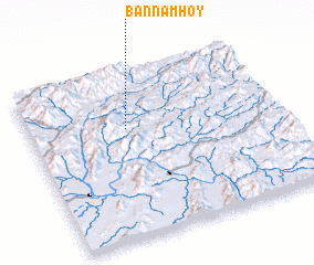 Places with similar names to Ban Namhoy, Laos ::
// Ban Mae Ha (TH)
// Ban Mae Hae (TH)
// Ban Mae Hae (TH)
// Ban Mae Hae (TH)
// Ban Mae Hai (TH)
// Ban Mae Hao (TH)
// Ban Mae Hi (TH)
// Ban Mae Hi (TH)
// Ban Mae Ho (TH)
// Ban Mae Ho (TH)
Disclaimer :: Information on this page comes without warranty of any kind |
||
|
Where is Ban Namhoy? Elevation and coordinates ::
Latitude (lat): 20°39'59"N Longitude (lon): 100°23'36"E
Elevation (approx.): 655m (map arrows pan, magnifying glasses zoom) |
||
|
Visiting Ban Namhoy? Hotel/Accommodation ::
Book a hotel in Ban Namhoy Travel Guide ::
Buy a travel guide for Laos rental cars ::
car rental offers GPS waypoint ::
download a GPX waypoint (PoI) of Ban Namhoy for your GPS receiver
|
||