|
search place name
|
||
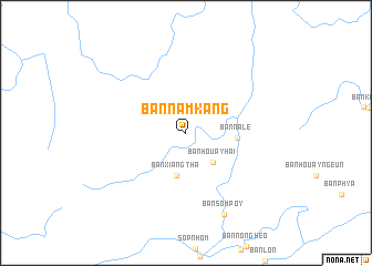
Ban Namkang (Phôngsali, Laos)Ban Namkang is a town in the Phôngsali region of Laos. An overview map of the region around Ban Namkang is displayed below.
regional and 3d topo map of Ban Namkang, Laos ::
Ban Namkang airports ::
The nearest airport is LPQ - Luang Prabang Luang Phabang Intl, located 203.1 km south of Ban Namkang.
Nearby towns ::
Ban Houayhai (3.9km south east) //
Ban Xiangtha (4.4km south) //
Ban Nalè (4.9km east) //
Ban Sômpoy (9.0km south east) //
[all distances 'as the bird flies' and approximate] 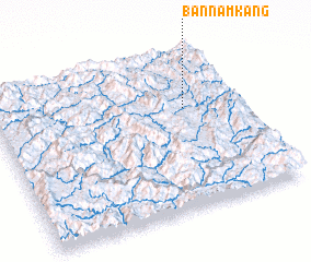 Places with similar names to Ban Namkang, Laos ::
// Ban Mae Kaeng (TH)
// Ban Mae Kang (TH)
// Ban Mae Kung (TH)
// Ban Omkong (TH)
// Ban Môkkoang (LA)
// Ban Môkkoang (LA)
// Ban Môkkông (LA)
// Ban Namkang (LA)
// Ban Nam Kèng (LA)
// Ban Namkiang (LA)
Disclaimer :: Information on this page comes without warranty of any kind |
||
|
Where is Ban Namkang? Elevation and coordinates ::
Latitude (lat): 21°38'19"N Longitude (lon): 102°46'31"E
Elevation (approx.): 678m (map arrows pan, magnifying glasses zoom) |
||
|
Visiting Ban Namkang? Hotel/Accommodation ::
Book a hotel in Ban Namkang Travel Guide ::
Buy a travel guide for Laos rental cars ::
car rental offers GPS waypoint ::
download a GPX waypoint (PoI) of Ban Namkang for your GPS receiver
|
||