|
search place name
|
||
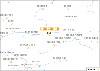
Ban Pak-En (Xaignabouli, Laos)Ban Pak-En is a town in the Xaignabouli region of Laos. An overview map of the region around Ban Pak-En is displayed below.
regional and 3d topo map of Ban Pak-En, Laos ::
Ban Pak-En airports ::
The nearest airport is LPQ - Luang Prabang Luang Phabang Intl, located 78.5 km east of Ban Pak-En.
Other airports nearby include THL - Tachilek Tachileik (171.6 km north west), PRH - Phrae (228.4 km south west), VTE - Vientiane Wattay Intl (235.7 km south east), KET - Kengtung (248.0 km north west), Nearby towns ::
Ban Khèngkhan (1.4km north west) //
Ban Houaytap (4.0km south) //
Ban Houaylai-Noy (5.2km south east) //
Ban Thaxoang (6.2km west) //
Ban Thanoun (6.9km east) //
Ban Poungkhan (9.1km south west) //
Ban Kioukhêt (9.7km north east) //
[all distances 'as the bird flies' and approximate] 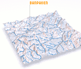 Places with similar names to Ban Pak-En, Laos ::
// Ban Po Ka Nua (TH)
// Ban Pok Nai (TH)
// Ban Pu Kon (TH)
// Ban Paka Noy (LA)
// Ban Pakkôn (LA)
// Ban Pakon (LA)
// Ban Pakouan (LA)
// Ban Pakouay Nua (LA)
// Ban Pak Uon (LA)
// Bản Pai Quanh (VN)
Disclaimer :: Information on this page comes without warranty of any kind |
||
|
Where is Ban Pak-En? Elevation and coordinates ::
Latitude (lat): 19°49'0"N Longitude (lon): 101°25'0"E
Elevation (approx.): 508m (map arrows pan, magnifying glasses zoom) |
||
|
Visiting Ban Pak-En? Hotel/Accommodation ::
Book a hotel in Ban Pak-En Travel Guide ::
Buy a travel guide for Laos rental cars ::
car rental offers GPS waypoint ::
download a GPX waypoint (PoI) of Ban Pak-En for your GPS receiver
|
||