|
search place name
|
||
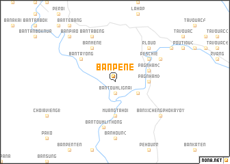
Ban Péné (Laos)Ban Péné is a town in Laos. An overview map of the region around Ban Péné is displayed below.
regional and 3d topo map of Ban Péné, Laos ::
Ban Péné airports ::
The nearest airport is PKZ - Pakse, located 150.8 km south west of Ban Péné.
Other airports nearby include DAD - Danang Intl (168.6 km east), ZVK - Savannakhet (203.7 km west), Nearby towns ::
Ban Toumli Gnai (1.9km south) //
Bane Tieune (4.0km south east) //
Pa Gnham (3) (5.3km east) //
Muang Tahoi (5.6km south) //
Pa Gnham (2) (5.7km east) //
Pe Schié (6.5km north east) //
Pa Gnham (6.5km north east) //
Ban Ta Yong (6.5km north west) //
Ban Méne (6.6km north west) //
Ban Toumli Thông (7.6km south) //
Ban Pasing (7.6km south) //
R Louo (7.7km north east) //
Ban Ta Beng (8.2km north west) //
Pa Gnham (1) (8.0km north east) //
Ban Xichèng-Phokayoy (9.0km south east) //
Ban Piao (10.3km north west) //
Ban Patoi (10.3km north west) //
[all distances 'as the bird flies' and approximate] 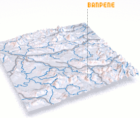 Places with similar names to Ban Péné, Laos ::
// Binapon (PH)
// Ban Na Pan (TH)
// Ban Na Pan (TH)
// Ban Na Po Nua (TH)
// Ban Na Pun (TH)
// Ban Na Pun (TH)
// Ban Paen (TH)
// Ban Paen (TH)
// Ban Paen (TH)
// Ban Pan (TH)
Disclaimer :: Information on this page comes without warranty of any kind |
||
|
Where is Ban Péné? Elevation and coordinates ::
Latitude (lat): 16°13'0"N Longitude (lon): 106°38'0"E
Elevation (approx.): 390m (map arrows pan, magnifying glasses zoom) |
||
|
Visiting Ban Péné? Hotel/Accommodation ::
Book a hotel in Ban Péné Travel Guide ::
Buy a travel guide for Laos rental cars ::
car rental offers GPS waypoint ::
download a GPX waypoint (PoI) of Ban Péné for your GPS receiver
|
||