|
search place name
|
||
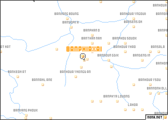
Ban Phiaxai (Houaphan, Laos)Ban Phiaxai is a town in the Houaphan region of Laos. An overview map of the region around Ban Phiaxai is displayed below.
regional and 3d topo map of Ban Phiaxai, Laos ::
Ban Phiaxai airports ::
The nearest airport is LPQ - Luang Prabang Luang Phabang Intl, located 170.9 km west of Ban Phiaxai.
Nearby towns ::
Ban Chathao (0.0km north) //
Ban Houayma-Nua (0.7km east) //
Ban Houayma (1.7km south) //
Ban Phathi (2.5km north east) //
Ban Thamnam (4.1km north east) //
Ban Houaymèngdan (4.1km south west) //
Ban Poungdik (5.2km east) //
Ban Phano (5.8km north) //
Ban Muanggnut (5.9km east) //
Ban Houayxuang (6.2km north west) //
Ban Houaybao (6.4km north east) //
Ban Sôpka (7.8km north) //
[all distances 'as the bird flies' and approximate] 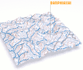 Places with similar names to Ban Phiaxai, Laos ::
// Benafigos (ES)
// Ban Pha Ka Sa (LA)
// Ban Phaksa (LA)
// Ban Phaxai (LA)
// Ban Phaxai (LA)
// Ban Phiaxai (LA)
// Ban Phiaxaí (LA)
// Ban Phouxa (LA)
// Ban Phouxè (LA)
// Ban Phôxai (LA)
Disclaimer :: Information on this page comes without warranty of any kind |
||
|
Where is Ban Phiaxai? Elevation and coordinates ::
Latitude (lat): 20°25'0"N Longitude (lon): 103°42'0"E
Elevation (approx.): 1104m (map arrows pan, magnifying glasses zoom) |
||
|
Visiting Ban Phiaxai? Hotel/Accommodation ::
Book a hotel in Ban Phiaxai Travel Guide ::
Buy a travel guide for Laos rental cars ::
car rental offers GPS waypoint ::
download a GPX waypoint (PoI) of Ban Phiaxai for your GPS receiver
|
||