|
search place name
|
||
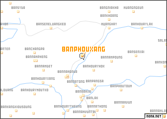
Ban Phouxang (Oudômxai, Laos)Ban Phouxang is a town in the Oudômxai region of Laos. An overview map of the region around Ban Phouxang is displayed below.
regional and 3d topo map of Ban Phouxang, Laos ::
Ban Phouxang airports ::
The nearest airport is LPQ - Luang Prabang Luang Phabang Intl, located 127.3 km south of Ban Phouxang.
Other airports nearby include THL - Tachilek Tachileik (198.5 km west), Nearby towns ::
Ban Houaykathing (1.1km north west) //
Muang Namo (1.6km north) //
Ban Houayhôk (3.2km south east) //
Ban Namo-Nua (4.9km south west) //
Ban Houalouang (5.2km south west) //
Ban Namo-Tai (5.5km south west) //
Ban Natong (6.1km south) //
Ban Pangsa (6.2km south east) //
Ban Nampoung (5.9km east) //
Ban Paknamtong (6.9km south) //
Ban Namxè (8.1km south) //
Ban Houay-On (8.5km south) //
Muang Hay (8.9km north east) //
Ban Nakham (9.1km south west) //
Ban Sene Luang Keo (9.8km north west) //
Ban Phoutoum (10.4km south east) //
[all distances 'as the bird flies' and approximate] 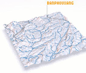 Places with similar names to Ban Phouxang, Laos ::
// Ban Phaxang (LA)
// Ban Phiaxang (LA)
// Ban Phouxang (LA)
// Ban Phouxang (LA)
// Ban Phouxang (LA)
Disclaimer :: Information on this page comes without warranty of any kind |
||
|
Where is Ban Phouxang? Elevation and coordinates ::
Latitude (lat): 20°59'10"N Longitude (lon): 101°45'55"E
Elevation (approx.): 817m (map arrows pan, magnifying glasses zoom) |
||
|
Visiting Ban Phouxang? Hotel/Accommodation ::
Book a hotel in Ban Phouxang Travel Guide ::
Buy a travel guide for Laos rental cars ::
car rental offers GPS waypoint ::
download a GPX waypoint (PoI) of Ban Phouxang for your GPS receiver
|
||