|
search place name
|
||
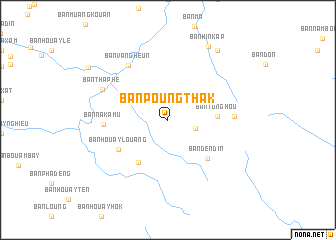
Ban Poungthak (Houaphan, Laos)Ban Poungthak is a town in the Houaphan region of Laos. An overview map of the region around Ban Poungthak is displayed below.
regional and 3d topo map of Ban Poungthak, Laos ::
Ban Poungthak airports ::
The nearest airport is HAN - Hanoi Noibai Intl, located 206.6 km north east of Ban Poungthak.
Nearby towns ::
Ban Houaysamat (3.0km east) //
Ban Tonghou (5.2km east) //
Ban Kèokout (5.7km south west) //
Ban Dèndin (6.0km south east) //
Ban Houaylouang (6.2km south west) //
Ban Nakamu (6.8km west) //
Ban Phapia (7.0km east) //
Ban Vangheun (7.4km north west) //
Ban Thaphè (7.7km north west) //
Ban Hinkap (9.2km north east) //
Ban Then (9.4km north east) //
Ban Nonglao (10.2km north west) //
[all distances 'as the bird flies' and approximate] 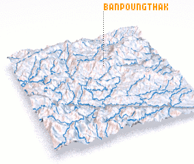 Places with similar names to Ban Poungthak, Laos :: Disclaimer :: Information on this page comes without warranty of any kind |
||
|
Where is Ban Poungthak? Elevation and coordinates ::
Latitude (lat): 19°43'48"N Longitude (lon): 104°37'0"E
Elevation (approx.): 898m (map arrows pan, magnifying glasses zoom) |
||
|
Visiting Ban Poungthak? Hotel/Accommodation ::
Book a hotel in Ban Poungthak Travel Guide ::
Buy a travel guide for Laos rental cars ::
car rental offers GPS waypoint ::
download a GPX waypoint (PoI) of Ban Poungthak for your GPS receiver
|
||