|
search place name
|
||
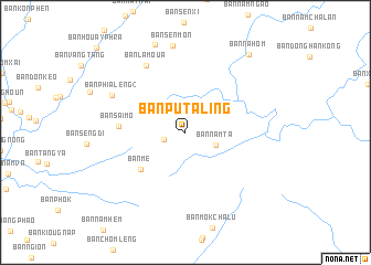
Ban Putaling (Oudômxai, Laos)Ban Putaling is a town in the Oudômxai region of Laos. An overview map of the region around Ban Putaling is displayed below.
regional and 3d topo map of Ban Putaling, Laos ::
Ban Putaling airports ::
The nearest airport is LPQ - Luang Prabang Luang Phabang Intl, located 62.4 km south east of Ban Putaling.
Other airports nearby include THL - Tachilek Tachileik (179.9 km west), KET - Kengtung (243.9 km north west), PRH - Phrae (268.0 km south west), Nearby towns ::
Ban Môkphon (2.2km west) //
Ban Phialèng (2.7km north west) //
Ban Namta (3.2km south east) //
Ban Mè (5.6km south west) //
Ban Saimo (6.4km west) //
Ban Lamoua (7.7km north west) //
Ban Phialéng (2) (7.9km north west) //
Ban Sènmon (8.8km north) //
Ban Kôk-Hai (9.4km north) //
Ban Nahôm (9.9km north east) //
[all distances 'as the bird flies' and approximate] 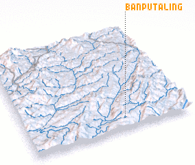 Places with similar names to Ban Putaling, Laos ::
// Bản Pột Luong (VN)
Disclaimer :: Information on this page comes without warranty of any kind |
||
|
Where is Ban Putaling? Elevation and coordinates ::
Latitude (lat): 20°7'24"N Longitude (lon): 101°36'52"E
Elevation (approx.): 1041m (map arrows pan, magnifying glasses zoom) |
||
|
Visiting Ban Putaling? Hotel/Accommodation ::
Book a hotel in Ban Putaling Travel Guide ::
Buy a travel guide for Laos rental cars ::
car rental offers GPS waypoint ::
download a GPX waypoint (PoI) of Ban Putaling for your GPS receiver
|
||