|
search place name
|
||
Ban Samnakmuang (Louangnamtha, Laos)Ban Samnakmuang is a town in the Louangnamtha region of Laos. An overview map of the region around Ban Samnakmuang is displayed below.
regional and 3d topo map of Ban Samnakmuang, Laos ::

Ban Samnakmuang airports ::
The nearest airport is THL - Tachilek Tachileik, located 119.3 km west of Ban Samnakmuang.
Other airports nearby include LPQ - Luang Prabang Luang Phabang Intl (143.8 km south east), KET - Kengtung (163.4 km north west), MOG - Mong Hsat (188.9 km west), Nearby towns ::
Viangphoukha (0.7km north east) //
Ban Thiao (1.1km north) //
Ban Vieng (2.4km east) //
Ban Nongkham (2.8km north east) //
Ban Tang Noeua (3.3km south) //
Ban Lavè (4.6km south west) //
Ban Pon Ping (4.7km north east) //
Pako (4.6km south east) //
Ban Takèo (6.6km south) //
Ban Houaydam (7.0km south) //
Ban Nam-Ô (6.8km north east) //
Ban Chang-Oung (7.1km west) //
Ban Namkiang (7.9km south east) //
Ban Kouy (8.0km west) //
Muang Ngeun (8.9km south) //
Ban Namsaton (8.9km south east) //
Ban Namxua (9.3km south east) //
Ban Eng (9.1km north east) //
Ban Yao (9.2km north west) //
Ban Phoulèk (10.3km south east) //
[all distances 'as the bird flies' and approximate] 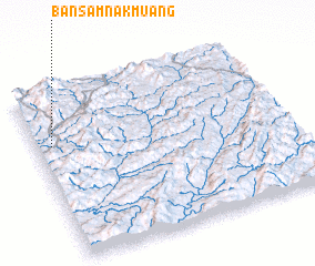 Places with similar names to Ban Samnakmuang, Laos ::
// Ban Samnak Muang (TH)
Disclaimer :: Information on this page comes without warranty of any kind |
||
|
Where is Ban Samnakmuang? Elevation and coordinates ::
Latitude (lat): 20°40'46"N Longitude (lon): 101°3'40"E
Elevation (approx.): 677m (map arrows pan, magnifying glasses zoom) |
||
|
Visiting Ban Samnakmuang? Hotel/Accommodation ::
Book a hotel in Ban Samnakmuang Travel Guide ::
Buy a travel guide for Laos rental cars ::
car rental offers GPS waypoint ::
download a GPX waypoint (PoI) of Ban Samnakmuang for your GPS receiver
|
||