|
search place name
|
||
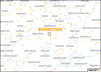
Ban Samxoum (Louangphrabang, Laos)Ban Samxoum is a town in the Louangphrabang region of Laos. An overview map of the region around Ban Samxoum is displayed below.
regional and 3d topo map of Ban Samxoum, Laos ::
Ban Samxoum airports ::
The nearest airport is LPQ - Luang Prabang Luang Phabang Intl, located 128.0 km south west of Ban Samxoum.
Nearby towns ::
Sen Vo (0.7km north) //
Nam Douane Neua (0.7km north) //
Nam Douane Kang (1.1km south) //
Ban Sômphou (1.9km north) //
Ban Kang (1.9km south east) //
Ban Nam Bout (2.6km north) //
Ban Pha-Ong (2.8km south west) //
Douane Teu (3.0km south) //
Ban Houayngou (3.2km north east) //
Sam Phou (3.7km west) //
Ban Lan-Nua (4.1km west) //
Nam Phou (5.2km east) //
Ban Sa-Duy (5.4km north east) //
Sam Soum (5.6km north east) //
Ban Kongmouan (5.5km north east) //
Ban Kading (5.9km north west) //
Ban Lang-Uat (5.9km south) //
Pha Hong (5.9km south east) //
Hue (5.8km north east) //
Kung Kating (6.3km north) //
Om Dur (6.5km north) //
Om Piru (6.5km north) //
Ban Môklep (6.7km south east) //
Houay Na (6.9km south) //
Ban Môk-Uay (6.8km east) //
Ban Lassa (7.2km north east) //
Ban Viangkhan (7.1km west) //
Houay Sanam (7.5km south east) //
Ban Houaylo (7.8km north east) //
[all distances 'as the bird flies' and approximate] 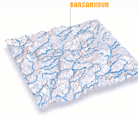 Places with similar names to Ban Samxoum, Laos ::
// Ban Samxoum (LA)
Disclaimer :: Information on this page comes without warranty of any kind |
||
|
Where is Ban Samxoum? Elevation and coordinates ::
Latitude (lat): 20°56'36"N Longitude (lon): 102°41'1"E
Elevation (approx.): 913m (map arrows pan, magnifying glasses zoom) |
||
|
Visiting Ban Samxoum? Hotel/Accommodation ::
Book a hotel in Ban Samxoum Travel Guide ::
Buy a travel guide for Laos rental cars ::
car rental offers GPS waypoint ::
download a GPX waypoint (PoI) of Ban Samxoum for your GPS receiver
|
||