|
search place name
|
||
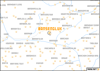
Ban Sèngluk (Phôngsali, Laos)Ban Sèngluk is a town in the Phôngsali region of Laos. An overview map of the region around Ban Sèngluk is displayed below.
regional and 3d topo map of Ban Sèngluk, Laos ::
Ban Sèngluk airports ::
The nearest airport is LPQ - Luang Prabang Luang Phabang Intl, located 141.2 km south of Ban Sèngluk.
Nearby towns ::
Ban Sèn-In (0.6km north) //
Kung Luk (1.5km north) //
Ban Noua (3.4km south east) //
Ban Kôkngiou (3.6km north west) //
Ban Hatphuak (3.9km south east) //
Ban Gnakha (3.7km west) //
Kung Sala (3.8km north east) //
Ban Houaychanum (4.4km south east) //
Ban Sènkounglouk (4.5km north) //
Kok Niu (4.8km north west) //
Ban Hatdén (4.9km south west) //
Ban Ômtot (5.7km north) //
Ban Laoko (5.8km north) //
Pia Cha Num (6.0km south) //
Ban Chum (5.7km south east) //
Ban Môkchala (6.0km north east) //
Kung Plat (6.2km south) //
Ban Phachôn (5.9km east) //
Ban Tanha (6.2km south west) //
Ban Hatpon (6.1km south east) //
Ban Xong-Nua (6.8km north) //
Ban Hatdi (6.6km south east) //
Nok Peng (6.6km south west) //
Ban Môk-Ak (6.8km north west) //
Ban Tabap (7.0km south) //
Tham Ha (6.9km south west) //
Ban Poung (6.6km north east) //
Ban Konghang (7.0km south) //
Ban Sangkhèn (7.5km north east) //
[all distances 'as the bird flies' and approximate] 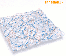 Places with similar names to Ban Sèngluk, Laos :: Disclaimer :: Information on this page comes without warranty of any kind |
||
|
Where is Ban Sèngluk? Elevation and coordinates ::
Latitude (lat): 21°5'13"N Longitude (lon): 102°38'59"E
Elevation (approx.): 753m (map arrows pan, magnifying glasses zoom) |
||
|
Visiting Ban Sèngluk? Hotel/Accommodation ::
Book a hotel in Ban Sèngluk Travel Guide ::
Buy a travel guide for Laos rental cars ::
car rental offers GPS waypoint ::
download a GPX waypoint (PoI) of Ban Sèngluk for your GPS receiver
|
||