|
search place name
|
||
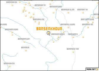
Ban Sènkhoun (Khammouan, Laos)Ban Sènkhoun is a town in the Khammouan region of Laos. An overview map of the region around Ban Sènkhoun is displayed below.
regional and 3d topo map of Ban Sènkhoun, Laos ::
Ban Sènkhoun airports ::
The nearest airport is SNO - Sakon Nakhon, located 133.9 km south west of Ban Sènkhoun.
Other airports nearby include ZVK - Savannakhet (171.0 km south), Nearby towns ::
Ban Vangphala (2.8km south east) //
Ban Phônbông (3.3km east) //
Ban Nakang (3.4km south east) //
Ban Phôn Bok (5.1km east) //
Ban Sôpphak (5.9km north west) //
Ban Sam Hing (6.3km north west) //
Ban Hinlôn (7.4km north west) //
Ban Nong Leung (7.4km north east) //
Ban Phakhoun (8.8km north) //
Ban Sôphoy (9.0km north west) //
Ban Kang (9.7km north west) //
Ban Donxat (9.8km north west) //
Ban Nathômkouang (10.0km north west) //
Ban Pounglan (11.0km north east) //
Ban Tônsan (11.4km north west) //
[all distances 'as the bird flies' and approximate]  Places with similar names to Ban Sènkhoun, Laos ::
// Ban Saen Khan (TH)
// Ban Sai Na Khan (TH)
// Ban Si Nakhon (TH)
// Ban Suan Khuan (TH)
// Ban Sankhoun (LA)
// Ban Sènkhan (LA)
// Ban Sênkhan (LA)
// Ban Sènkhan-Nua (LA)
// Ban Sènkhouan (LA)
// Ban Sènkhouan (LA)
Disclaimer :: Information on this page comes without warranty of any kind |
||
|
Where is Ban Sènkhoun? Elevation and coordinates ::
Latitude (lat): 18°5'19"N Longitude (lon): 104°58'10"E
Elevation (approx.): 495m (map arrows pan, magnifying glasses zoom) |
||
|
Visiting Ban Sènkhoun? Hotel/Accommodation ::
Book a hotel in Ban Sènkhoun Travel Guide ::
Buy a travel guide for Laos rental cars ::
car rental offers GPS waypoint ::
download a GPX waypoint (PoI) of Ban Sènkhoun for your GPS receiver
|
||