|
search place name
|
||
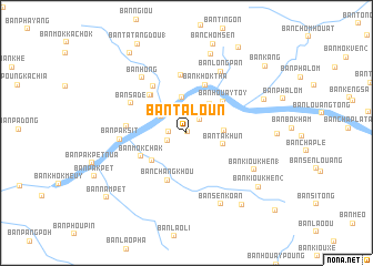
Ban Taloun (Xaignabouli, Laos)Ban Taloun is a town in the Xaignabouli region of Laos. An overview map of the region around Ban Taloun is displayed below.
regional and 3d topo map of Ban Taloun, Laos ::
Ban Taloun airports ::
The nearest airport is THL - Tachilek Tachileik, located 113.3 km north west of Ban Taloun.
Other airports nearby include LPQ - Luang Prabang Luang Phabang Intl (142.6 km east), MOG - Mong Hsat (176.6 km north west), KET - Kengtung (200.0 km north west), PRH - Phrae (203.2 km south), Nearby towns ::
Ban Khamou (2) (0.1km north east) //
Ban Khamou (1) (1.7km west) //
Ban Kioukèn (1.9km north east) //
Ban Khamou (2.0km south west) //
Ban Pak Kham (2.6km north west) //
Ban Houaykhoun (2.9km north west) //
Ban Houaysa (3.6km north) //
Ban Phoulouang (3.7km north east) //
Ban Môkphalao (3.5km east) //
Ban Takhun (3.7km east) //
Ban Môkchakian (4.3km south west) //
Ban Houaytoy (4.7km north east) //
Ban Changkhou (5.1km south) //
Ban Môkchak (4.9km south west) //
Ban Khôktha (5.2km north) //
Ban Houaymông (5.1km north west) //
Ban Khamou (3) (5.1km north west) //
Ban Môkpalai (5.7km north west) //
Ban Khôkka (5.8km north) //
Ban Houay-Èt (5.7km west) //
Ban Sadê (6.0km north west) //
Ban Paksit (6.3km west) //
Ban Longpan (7.0km north east) //
Ban Hong (7.0km north west) //
Ban Kioukhèn (1) (7.4km south east) //
Ban Sènkoan (7.9km south east) //
Ban Chomsén (8.3km north) //
Ban Kèngvè (8.1km north east) //
Ban Kioukhèn (2) (8.7km south east) //
[all distances 'as the bird flies' and approximate]  Places with similar names to Ban Taloun, Laos ::
// Bantilan (PH)
// Bantulin (PH)
// Bantolinao (PH)
// Bantolinao (PH)
// Bantolinao (PH)
// Bantolinao (PH)
// Bantolinaw (PH)
// Bantulan (PH)
// Bintoulan (PH)
// Bondolan (PH)
Disclaimer :: Information on this page comes without warranty of any kind |
||
|
Where is Ban Taloun? Elevation and coordinates ::
Latitude (lat): 19°51'56"N Longitude (lon): 100°47'58"E
Elevation (approx.): 672m (map arrows pan, magnifying glasses zoom) |
||
|
Visiting Ban Taloun? Hotel/Accommodation ::
Book a hotel in Ban Taloun Travel Guide ::
Buy a travel guide for Laos rental cars ::
car rental offers GPS waypoint ::
download a GPX waypoint (PoI) of Ban Taloun for your GPS receiver
|
||