|
search place name
|
||
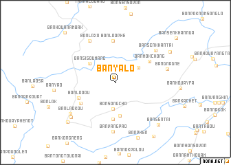
Ban Yalô (Louangphrabang, Laos)Ban Yalô is a town in the Louangphrabang region of Laos. An overview map of the region around Ban Yalô is displayed below.
regional and 3d topo map of Ban Yalô, Laos ::
Ban Yalô airports ::
The nearest airport is LPQ - Luang Prabang Luang Phabang Intl, located 78.9 km south of Ban Yalô.
Nearby towns ::
Ban Song Cha (4.3km south) //
Ban Louk (4.3km north east) //
Ban Sisoumang (5.0km north west) //
Ban Laoma (5.4km south) //
Ban Sèn-Nua (5.9km south) //
Ban Lao-Ou (6.1km south west) //
Ban Môkchông (6.2km north east) //
Ban Nammiang (6.2km south west) //
Ban Lao Phê (6.8km north) //
Ban Laxa (7.8km north west) //
Ban Vangpao (8.0km south) //
Ban Sènkhan-Tai (8.0km north east) //
Ban Gnagnè (8.2km east) //
Ban Laokou (8.5km south west) //
Ban Laoli (8.8km south west) //
Ban Sèn-Tai (9.5km south east) //
Ban Nam Mieng (9.6km north east) //
Ban Laova (9.8km south west) //
Ban Kalang (10.5km south east) //
Ban Houanambak (11.1km north west) //
[all distances 'as the bird flies' and approximate]  Places with similar names to Ban Yalô, Laos ::
// Ban Yai La (TH)
// Ban Yai Liu (TH)
// Ban Yai Liu (TH)
// Ban Ya Le (TH)
// Bonyolo (BF)
// Banayale (CD)
// Bannayili (GH)
// Binayili (GH)
// Bunyolo (UG)
// Ban Yalô (LA)
Disclaimer :: Information on this page comes without warranty of any kind |
||
|
Where is Ban Yalô? Elevation and coordinates ::
Latitude (lat): 20°36'20"N Longitude (lon): 102°15'14"E
Elevation (approx.): 1163m (map arrows pan, magnifying glasses zoom) |
||
|
Visiting Ban Yalô? Hotel/Accommodation ::
Book a hotel in Ban Yalô Travel Guide ::
Buy a travel guide for Laos rental cars ::
car rental offers GPS waypoint ::
download a GPX waypoint (PoI) of Ban Yalô for your GPS receiver
|
||