|
search place name
|
||
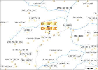
Khun Suc (Laos)Khun Suc is a town in Laos. An overview map of the region around Khun Suc is displayed below.
regional and 3d topo map of Khun Suc, Laos ::
Khun Suc airports ::
The nearest airport is LPQ - Luang Prabang Luang Phabang Intl, located 201.4 km south of Khun Suc.
Nearby towns ::
Ban Khounsouklouang (1.7km north west) //
Khun Suc (1.9km north) //
Cha Kham Pa (1.7km east) //
Ban Laha (2.0km south) //
Ban Khounsouk-Noy (2.6km west) //
Ban Laolong (3.1km south west) //
Ban Pangxo (3.4km east) //
Mecho Pan (3.4km east) //
Phôngsali (4.7km south west) //
Ban Pachantan (6.0km west) //
Ban Phagnéxi (7.2km south) //
Ban Maochaolouang (7.4km south west) //
Ban Khomèn (7.6km south) //
Ban Hatxa (7.3km north east) //
Chang Tong (7.6km north west) //
Ban Tang (7.7km west) //
Ban Tapat (8.0km west) //
Ban Hatxông (7.9km east) //
Cha Kham Sen (8.9km north west) //
Ban Changtuan (11.0km north west) //
[all distances 'as the bird flies' and approximate] 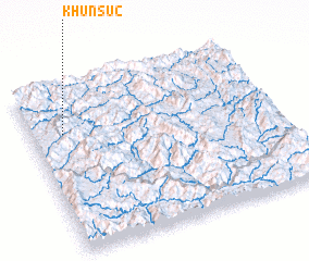 Places with similar names to Khun Suc, Laos ::
Disclaimer :: Information on this page comes without warranty of any kind |
||
|
Where is Khun Suc? Elevation and coordinates ::
Latitude (lat): 21°43'0"N Longitude (lon): 102°8'0"E
Elevation (approx.): 1309m (map arrows pan, magnifying glasses zoom) |
||
|
Visiting Khun Suc? Hotel/Accommodation ::
Book a hotel in Khun Suc Travel Guide ::
Buy a travel guide for Laos rental cars ::
car rental offers GPS waypoint ::
download a GPX waypoint (PoI) of Khun Suc for your GPS receiver
|
||