|
search place name
|
||
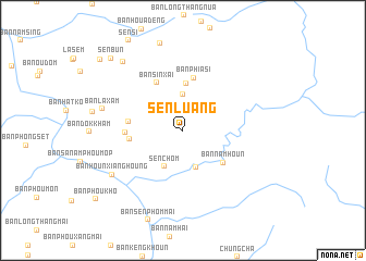
Sen Luang (Laos)Sen Luang is a town in Laos. An overview map of the region around Sen Luang is displayed below.
regional and 3d topo map of Sen Luang, Laos ::
Sen Luang airports ::
The nearest airport is LPQ - Luang Prabang Luang Phabang Intl, located 195.2 km south of Sen Luang.
Nearby towns ::
Xe Long Quang Mang (1.9km north) //
Ban Sènlouang (2.6km north) //
Sen Sai (1) (3.7km north) //
Ban Nongkham (4.0km south) //
Sen Chom (4.1km south west) //
Ban Phagnasi (4.8km north) //
Ban Namhoun (5.0km south east) //
Ban Phiasi (5.5km north) //
Ban Sinxai (5.5km north west) //
Ban Sala-Loum (5.2km west) //
Ban Sala Theung (5.3km west) //
Ban Phiaxaí (5.5km west) //
BanHounxianghoung (8.1km south west) //
Ban Laxam (8.0km west) //
Ban Phoulouangchan (9.0km north west) //
Sen Bun (10.1km north west) //
Ban Kiou (10.7km north west) //
[all distances 'as the bird flies' and approximate]  Places with similar names to Sen Luang, Laos ::
// Sanlong (MM)
// Senlung (MM)
// Sinhlaung (MM)
// Sinlaung (MM)
// Sinlu-aing (MM)
// Sinluaing (MM)
// Sinlung Ga (MM)
// Son Laing (MM)
// Snelling (US)
// Senaling (MY)
Disclaimer :: Information on this page comes without warranty of any kind |
||
|
Where is Sen Luang? Elevation and coordinates ::
Latitude (lat): 21°39'0"N Longitude (lon): 102°22'0"E
Elevation (approx.): 1026m (map arrows pan, magnifying glasses zoom) |
||
|
Visiting Sen Luang? Hotel/Accommodation ::
Book a hotel in Sen Luang Travel Guide ::
Buy a travel guide for Laos rental cars ::
car rental offers GPS waypoint ::
download a GPX waypoint (PoI) of Sen Luang for your GPS receiver
|
||