|
search place name
|
||
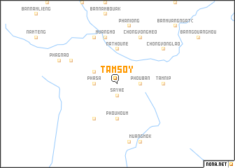
Tam Soy (Xiangkhoang, Laos)Tam Soy is a town in the Xiangkhoang region of Laos. An overview map of the region around Tam Soy is displayed below.
regional and 3d topo map of Tam Soy, Laos ::
Tam Soy airports ::
The nearest airport is VTE - Vientiane Wattay Intl, located 187.2 km south west of Tam Soy.
Other airports nearby include SNO - Sakon Nakhon (200.3 km south), LPQ - Luang Prabang Luang Phabang Intl (215.7 km north west), UTH - Udon Thani (218.8 km south west), Nearby towns ::
Nam Say (1.9km south) //
Say He (1.9km south) //
Pha Sa (3.5km west) //
Phou Ban (3.5km east) //
Ban Phu Soung (4.0km north west) //
Pha Hoe (4.0km north west) //
Phou Houm (5.6km south) //
Na Thoune (5.6km north) //
Ban Nam Mong (6.6km south west) //
Tam Nip (7.0km east) //
Muang Mô (7.6km north) //
Kho Pang (7.9km north west) //
Ban Patho (7.9km north west) //
Ban Xieng Men (8.2km north west) //
Chong Vong Meo (8.2km north east) //
Chong Vong Lao (8.9km north east) //
[all distances 'as the bird flies' and approximate] 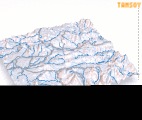 Places with similar names to Tam Soy, Laos ::
Disclaimer :: Information on this page comes without warranty of any kind |
||
|
Where is Tam Soy? Elevation and coordinates ::
Latitude (lat): 19°0'0"N Longitude (lon): 103°59'0"E
Elevation (approx.): 1162m (map arrows pan, magnifying glasses zoom) |
||
|
Visiting Tam Soy? Hotel/Accommodation ::
Book a hotel in Tam Soy Travel Guide ::
Buy a travel guide for Laos rental cars ::
car rental offers GPS waypoint ::
download a GPX waypoint (PoI) of Tam Soy for your GPS receiver
|
||