|
search place name
|
||
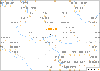
Tan Kau (Laos)Tan Kau is a town in Laos. An overview map of the region around Tan Kau is displayed below.
regional and 3d topo map of Tan Kau, Laos ::
Tan Kau airports ::
The nearest airport is DAD - Danang Intl, located 142.2 km east of Tan Kau.
Other airports nearby include PKZ - Pakse (177.6 km south west), Nearby towns ::
Ban Tay (1.9km north) //
Pril (1.9km north) //
Ban Tanlao (1.8km east) //
Ban Takô (2.6km north east) //
R'va (2) (2.6km south west) //
Ban Avahô (3.7km north) //
Achiang (3) (3.7km south) //
Achiang (2) (3.7km south) //
Ban Laan (4.0km south east) //
R'va (1) (4.0km south west) //
Achiang (1) (4.1km south east) //
Lalai (2) (5.3km east) //
Lalai (5.6km east) //
Lalai Dèo (5.6km east) //
Lalai (1) (5.6km east) //
Pril Riông (5.8km north) //
Meo (5.6km west) //
Ban Bouay (6.5km north east) //
A Tain (7.1km west) //
Pril (7.6km north) //
Làng Hang (7.4km east) //
A Tsin (7.4km west) //
Tam Boai (4) (9.1km north east) //
Atôk (9.1km south east) //
A Trup (1) (10.3km north west) //
Atouk (10.3km south east) //
[all distances 'as the bird flies' and approximate] 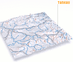 Places with similar names to Tan Kau, Laos ::
Disclaimer :: Information on this page comes without warranty of any kind |
||
|
Where is Tan Kau? Elevation and coordinates ::
Latitude (lat): 16°19'0"N Longitude (lon): 106°54'0"E
Elevation (approx.): 561m (map arrows pan, magnifying glasses zoom) |
||
|
Visiting Tan Kau? Hotel/Accommodation ::
Book a hotel in Tan Kau Travel Guide ::
Buy a travel guide for Laos rental cars ::
car rental offers GPS waypoint ::
download a GPX waypoint (PoI) of Tan Kau for your GPS receiver
|
||