|
search place name
|
||
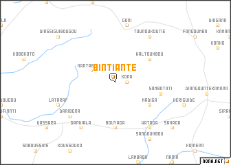
Bintianté (Mali)Bintianté is a town in Mali. An overview map of the region around Bintianté is displayed below.
regional and 3d topo map of Bintianté, Mali ::
Bintianté airports ::
The nearest airport is KYS - Kayes Dag Dag, located 189.3 km west of Bintianté.
Nearby towns ::
Kora (1.8km east) //
Martabougou (4.0km north west) //
Waltoumbou (6.5km north east) //
Madiga (6.5km south east) //
Bouyaga (7.4km south) //
Sambatati (7.4km east) //
Touroukoutié (9.2km north east) //
Daribéra (9.1km south west) //
Gandiala (9.2km south west) //
Wataga (9.2km south east) //
[all distances 'as the bird flies' and approximate] 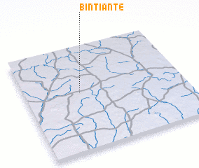 Places with similar names to Bintianté, Mali ::
// Ban Chan At (TH)
// Ban Chan De (TH)
// Ban Chanot (TH)
// Ban Chanot (TH)
// Ban Chanot (TH)
// Ban Chan Tai (TH)
// Ban Chon Dua (TH)
// Ban Chun Tai (TH)
// Ban Chandé (LA)
// Ban Chantai (LA)
Disclaimer :: Information on this page comes without warranty of any kind |
||
|
Where is Bintianté? Elevation and coordinates ::
Latitude (lat): 14°34'0"N Longitude (lon): 9°39'0"W
Elevation (approx.): 281m (map arrows pan, magnifying glasses zoom) |
||
|
Visiting Bintianté? Hotel/Accommodation ::
Book a hotel in Bintianté Travel Guide ::
Buy a travel guide for Mali rental cars ::
car rental offers GPS waypoint ::
download a GPX waypoint (PoI) of Bintianté for your GPS receiver
|
||