|
search place name
|
||
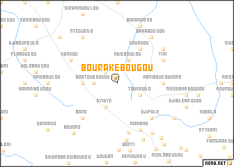
Bourakébougou (Mali)Bourakébougou is a town in Mali. An overview map of the region around Bourakébougou is displayed below.
regional and 3d topo map of Bourakébougou, Mali ::
Bourakébougou airports ::
The nearest airport is BKO - Bamako Senou, located 67.4 km south east of Bourakébougou.
Nearby towns ::
Ntiéniala (2.6km north west) //
Boatoubougou (3.6km west) //
Ndiébougou (4.1km north east) //
Touroudo (4.1km south east) //
Dyidyé (4.1km south west) //
Bassabougou (5.4km west) //
Koundou (6.6km north east) //
Maribougoukoro (7.2km east) //
Djifalé (7.8km south east) //
Boro (7.8km south west) //
Zorokoro (8.1km south) //
Tini (8.1km north east) //
Konkou (8.1km north west) //
Niamana (8.2km south east) //
Ntéguédo (9.2km north west) //
Bamabougou (9.2km north east) //
Balabougou (9.1km north east) //
Sohibabougou (9.1km north east) //
Ouarabougou (9.7km south east) //
Bouoro (10.5km south west) //
Bouadiougoubougou (11.2km south east) //
[all distances 'as the bird flies' and approximate] 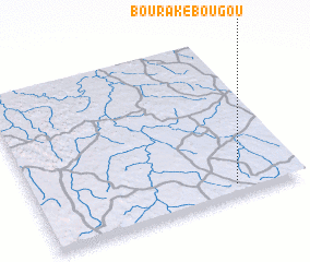 Places with similar names to Bourakébougou, Mali ::
// Baracbac (PH)
// Baracbac (PH)
// Baracbac (PH)
// Baracbac (PH)
// Barucbuc (PH)
// Birkbeck (US)
// Bargabouga (BF)
// Barakabougou (ML)
// Barakabougou (ML)
// Baregbeg (ID)
Disclaimer :: Information on this page comes without warranty of any kind |
||
|
Where is Bourakébougou? Elevation and coordinates ::
Latitude (lat): 13°4'0"N Longitude (lon): 8°15'0"W
Elevation (approx.): 419m (map arrows pan, magnifying glasses zoom) |
||
|
Visiting Bourakébougou? Hotel/Accommodation ::
Book a hotel in Bourakébougou Travel Guide ::
Buy a travel guide for Mali rental cars ::
car rental offers GPS waypoint ::
download a GPX waypoint (PoI) of Bourakébougou for your GPS receiver
|
||