|
search place name
|
||
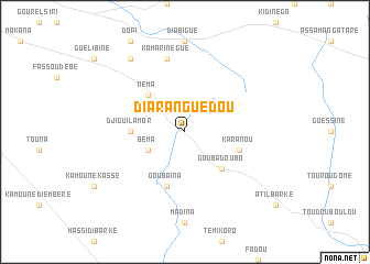
Diaranguédou (Mali)Diaranguédou is a town in Mali. An overview map of the region around Diaranguédou is displayed below.
regional and 3d topo map of Diaranguédou, Mali ::
Diaranguédou airports ::
The nearest airport is IEO - Aioun El Atrouss, located 185.2 km north of Diaranguédou.
Nearby towns ::
Béma (4.0km south west) //
Néma (5.2km north west) //
Goubadoubo (5.2km south east) //
Djiguilamor (5.4km west) //
Goubaïna (5.8km south) //
Karanou (5.7km east) //
Kamarinégué (7.6km north) //
Goulanbé (9.2km north west) //
[all distances 'as the bird flies' and approximate]  Places with similar names to Diaranguédou, Mali ::
// Taringuiti (BO)
// Darreh Naqdī (IR)
// Duriankiat (ID)
// Duranguito (MX)
// Duranguito (MX)
// Doranagoda (LK)
// Darān Kot (PK)
// Taerangt'o (KR)
// Tarangdo (KR)
// Tronquito (PY)
Disclaimer :: Information on this page comes without warranty of any kind |
||
|
Where is Diaranguédou? Elevation and coordinates ::
Latitude (lat): 15°4'0"N Longitude (lon): 9°19'0"W
Elevation (approx.): 290m (map arrows pan, magnifying glasses zoom) |
||
|
Visiting Diaranguédou? Hotel/Accommodation ::
Book a hotel in Diaranguédou Travel Guide ::
Buy a travel guide for Mali rental cars ::
car rental offers GPS waypoint ::
download a GPX waypoint (PoI) of Diaranguédou for your GPS receiver
|
||