|
search place name
|
||
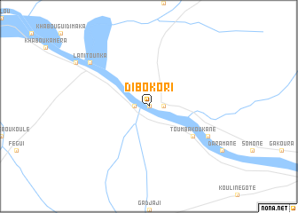
Dibokori (Mali)Dibokori is a town in Mali. An overview map of the region around Dibokori is displayed below.
regional and 3d topo map of Dibokori, Mali ::
Dibokori airports ::
The nearest airport is BXE - Bakel, located 55.9 km west of Dibokori.
Other airports nearby include SEY - Selibabi Selibady (61.7 km north west), KYS - Kayes Dag Dag (65.7 km east), TUD - Tambacounda (207.5 km south west), KFA - Kiffa (221.6 km north), Nearby towns ::
Sobokou (0.0km north) //
Gousséla (1.8km east) //
Digokori (1.8km west) //
Toumbakoukané (6.5km south east) //
Marana (8.1km south east) //
Lani Tounka (9.1km north west) //
Lani Modi (9.1km north west) //
[all distances 'as the bird flies' and approximate] 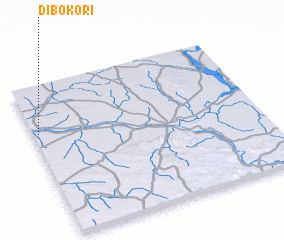 Places with similar names to Dibokori, Mali ::
Disclaimer :: Information on this page comes without warranty of any kind |
||
|
Where is Dibokori? Elevation and coordinates ::
Latitude (lat): 14°40'0"N Longitude (lon): 11°59'0"W
Elevation (approx.): 21m (map arrows pan, magnifying glasses zoom) |
||
|
Visiting Dibokori? Hotel/Accommodation ::
Book a hotel in Dibokori Travel Guide ::
Buy a travel guide for Mali rental cars ::
car rental offers GPS waypoint ::
download a GPX waypoint (PoI) of Dibokori for your GPS receiver
|
||