|
search place name
|
||
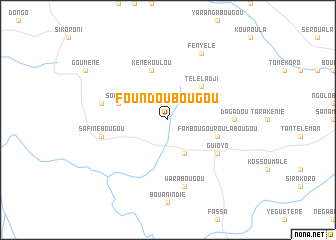
Foundoubougou (Mali)Foundoubougou is a town in Mali. An overview map of the region around Foundoubougou is displayed below.
regional and 3d topo map of Foundoubougou, Mali ::
Foundoubougou airports ::
The nearest airport is BKO - Bamako Senou, located 116.9 km south of Foundoubougou.
Nearby towns ::
Dyinindyébougou (4.1km south east) //
Téléladji (5.2km north east) //
Fambougouroulabougou (5.7km east) //
Kénékoulou (5.8km north) //
Sombani (5.7km west) //
Guioyo (6.6km south east) //
Dagadou (7.2km east) //
Warabougou (7.6km south) //
Safinébougou (7.4km west) //
Faranina (7.4km west) //
Kitianabougou (7.4km west) //
Fényélé (8.2km north east) //
[all distances 'as the bird flies' and approximate] 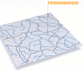 Places with similar names to Foundoubougou, Mali ::
// Vindé Boki (BF)
// Vinndeboki (SN)
// Fantabougou (ML)
// Fantabougou (ML)
// Fondabougou (ML)
// Fondoubougou (ML)
// Vindi Boké (MR)
// Vindebæk (DK)
Disclaimer :: Information on this page comes without warranty of any kind |
||
|
Where is Foundoubougou? Elevation and coordinates ::
Latitude (lat): 13°32'0"N Longitude (lon): 8°18'0"W
Elevation (approx.): 339m (map arrows pan, magnifying glasses zoom) |
||
|
Visiting Foundoubougou? Hotel/Accommodation ::
Book a hotel in Foundoubougou Travel Guide ::
Buy a travel guide for Mali rental cars ::
car rental offers GPS waypoint ::
download a GPX waypoint (PoI) of Foundoubougou for your GPS receiver
|
||