|
search place name
|
||
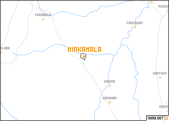
Minkamala (Mali)Minkamala is a town in Mali. An overview map of the region around Minkamala is displayed below.
regional and 3d topo map of Minkamala, Mali ::
Minkamala airports ::
The nearest airport is BKO - Bamako Senou, located 222.1 km north of Minkamala.
Other airports nearby include HGO - Korhogo (229.1 km south east), Nearby towns ::
Komina (7.8km south east) //
[all distances 'as the bird flies' and approximate]  Places with similar names to Minkamala, Mali ::
// Mangamila (MG)
// Manquimiliú (CL)
// Mangu-Mbale (CD)
// Mongmal (KR)
// Mongmal (KR)
// Mŏngmuul (KR)
// Mangumala (GQ)
// Muangamula (MZ)
// Mönhkamli (MM)
// Munkamåla (SE)
Disclaimer :: Information on this page comes without warranty of any kind |
||
|
Where is Minkamala? Elevation and coordinates ::
Latitude (lat): 10°40'0"N Longitude (lon): 7°12'0"W
Elevation (approx.): 337m (map arrows pan, magnifying glasses zoom) |
||
|
Visiting Minkamala? Hotel/Accommodation ::
Book a hotel in Minkamala Travel Guide ::
Buy a travel guide for Mali rental cars ::
car rental offers GPS waypoint ::
download a GPX waypoint (PoI) of Minkamala for your GPS receiver
|
||