|
search place name
|
||
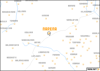
Naréna (Koulikoro, Mali)Naréna is a town in the Koulikoro region of Mali. An overview map of the region around Naréna is displayed below.
regional and 3d topo map of Naréna, Mali ::
Naréna airports ::
The nearest airport is BKO - Bamako Senou, located 81.5 km north east of Naréna.
Nearby towns ::
Kossouma (5.1km east) //
Bayan (5.8km south west) //
Kiniéma (6.6km north) //
Solabougouda (7.4km east) //
Labankono (7.7km south) //
Koulaka (7.6km west) //
Madouba (7.7km east) //
Bofé (7.7km east) //
Sébékourani (8.4km west) //
Farama (8.8km south) //
Kèngué (9.0km south east) //
Samalofira (9.5km north east) //
Lèflouni (10.2km south west) //
Mana (10.2km south east) //
Fadama (10.7km south east) //
[all distances 'as the bird flies' and approximate] 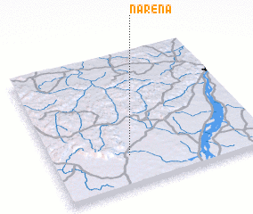 Places with similar names to Naréna, Mali ::
Disclaimer :: Information on this page comes without warranty of any kind |
||
|
Where is Naréna? Elevation and coordinates ::
Latitude (lat): 12°13'49"N Longitude (lon): 8°37'59"W
Elevation (approx.): 383m (map arrows pan, magnifying glasses zoom) |
||
|
Visiting Naréna? Hotel/Accommodation ::
Book a hotel in Naréna Travel Guide ::
Buy a travel guide for Mali rental cars ::
car rental offers GPS waypoint ::
download a GPX waypoint (PoI) of Naréna for your GPS receiver
|
||