|
search place name
|
||
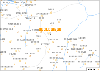
Ouolodièdo (Koulikoro, Mali)Ouolodièdo is a town in the Koulikoro region of Mali. An overview map of the region around Ouolodièdo is displayed below.
regional and 3d topo map of Ouolodièdo, Mali ::
Ouolodièdo airports ::
The nearest airport is BKO - Bamako Senou, located 30.5 km west of Ouolodièdo.
Nearby towns ::
Zeban (2.6km north east) //
Mounzoun (2.7km south east) //
Nkoniko (3.6km north west) //
Diko (3.8km north) //
Soro (4.4km west) //
Ntènèmè (4.5km south) //
Sirakoroni (5.2km south) //
Soroba (5.3km west) //
Diko (6.0km north east) //
Darabougou (6.3km south) //
Diandian (6.3km south west) //
Nionia (6.5km north west) //
Molobala (6.7km south east) //
Sikoroni (7.0km east) //
Blan (7.3km south west) //
Kobougou (7.7km south) //
Yayabougou (7.9km north) //
Koblébougou (7.8km east) //
Kasséla (8.4km north) //
Tangala (8.3km west) //
Diba (8.9km south east) //
Faradièla (9.3km north west) //
Sirafouka (9.3km south west) //
Sadiouroubougou (10.4km north west) //
Konyikoro (10.6km south west) //
[all distances 'as the bird flies' and approximate] 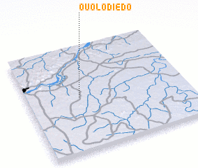 Places with similar names to Ouolodièdo, Mali ::
// Oulad Aïd (MA)
// Oulad Ayyad (MA)
// Oulad Daoud (MA)
// Oulad Daoud (MA)
// Ouled Aouda (MA)
// Ouled Daoud (MA)
// Old Duette (US)
// Olteţ (RO)
// Olteţu (RO)
// Olteţu (RO)
Disclaimer :: Information on this page comes without warranty of any kind |
||
|
Where is Ouolodièdo? Elevation and coordinates ::
Latitude (lat): 12°31'9"N Longitude (lon): 7°40'10"W
Elevation (approx.): 359m (map arrows pan, magnifying glasses zoom) |
||
|
Visiting Ouolodièdo? Hotel/Accommodation ::
Book a hotel in Ouolodièdo Travel Guide ::
Buy a travel guide for Mali rental cars ::
car rental offers GPS waypoint ::
download a GPX waypoint (PoI) of Ouolodièdo for your GPS receiver
|
||