|
search place name
|
||
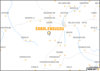
Sabalébougou (Mali)Sabalébougou is a town in Mali. An overview map of the region around Sabalébougou is displayed below.
regional and 3d topo map of Sabalébougou, Mali ::
Sabalébougou airports ::
The nearest airport is BKO - Bamako Senou, located 119.2 km south west of Sabalébougou.
Nearby towns ::
Bangalébougou (1.9km south) //
Galamadibi (2.6km south east) //
Kouna (3.7km north) //
Galo (5.2km south east) //
Zanbougou (5.6km north) //
Banamba (6.6km north east) //
Fadiola (6.6km north west) //
Falembougou (6.6km south east) //
Bougounina (7.4km north) //
Madiné (7.2km east) //
Béniani (7.4km west) //
Diassani (8.2km north east) //
Toumba (8.2km south east) //
Nomobougou (9.2km north east) //
Sinzéna (9.2km north east) //
Samakélé (9.1km north west) //
Gana (9.2km south east) //
[all distances 'as the bird flies' and approximate] 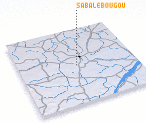 Places with similar names to Sabalébougou, Mali ::
Disclaimer :: Information on this page comes without warranty of any kind |
||
|
Where is Sabalébougou? Elevation and coordinates ::
Latitude (lat): 13°31'0"N Longitude (lon): 7°30'0"W
Elevation (approx.): 409m (map arrows pan, magnifying glasses zoom) |
||
|
Visiting Sabalébougou? Hotel/Accommodation ::
Book a hotel in Sabalébougou Travel Guide ::
Buy a travel guide for Mali rental cars ::
car rental offers GPS waypoint ::
download a GPX waypoint (PoI) of Sabalébougou for your GPS receiver
|
||