|
search place name
|
||
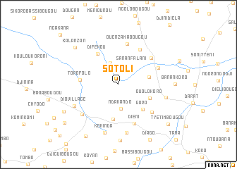
Sotoli (Koulikoro, Mali)Sotoli is a town in the Koulikoro region of Mali. An overview map of the region around Sotoli is displayed below.
regional and 3d topo map of Sotoli, Mali ::
Sotoli airports ::
The nearest airport is BKO - Bamako Senou, located 44.8 km south east of Sotoli.
Nearby towns ::
Bouabougou (3.6km north) //
Sananfalani (3.7km north east) //
Ndakando (3.8km south) //
Dianéguébougou Diago (4.9km east) //
Ouolokoro (5.3km south east) //
Goro (5.5km south east) //
Magnambougou (5.6km south) //
Difémou (5.8km north west) //
Torofolo (6.0km west) //
Ouassorola (6.4km north east) //
Ouènzamabougou (6.5km north) //
Kababougou (6.6km north east) //
Diéni (6.7km south) //
Sokolombougou (6.7km north east) //
Diago Koro (6.8km south east) //
Dio-Gare (7.3km south west) //
Kampaman (7.7km south) //
Dio-Village (7.6km south west) //
Fanafiè Koro (7.6km east) //
Kominda (8.0km south) //
Kalanzan (8.9km north west) //
Kamamba (9.4km south west) //
Tilanabougou (9.6km south west) //
Diago (10.0km south east) //
Tyètimbougou (9.9km south east) //
Donyimébougou (10.3km south west) //
[all distances 'as the bird flies' and approximate] 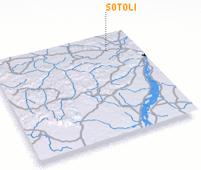 Places with similar names to Sotoli, Mali ::
Disclaimer :: Information on this page comes without warranty of any kind |
||
|
Where is Sotoli? Elevation and coordinates ::
Latitude (lat): 12°51'23"N Longitude (lon): 8°11'58"W
Elevation (approx.): 422m (map arrows pan, magnifying glasses zoom) |
||
|
Visiting Sotoli? Hotel/Accommodation ::
Book a hotel in Sotoli Travel Guide ::
Buy a travel guide for Mali rental cars ::
car rental offers GPS waypoint ::
download a GPX waypoint (PoI) of Sotoli for your GPS receiver
|
||